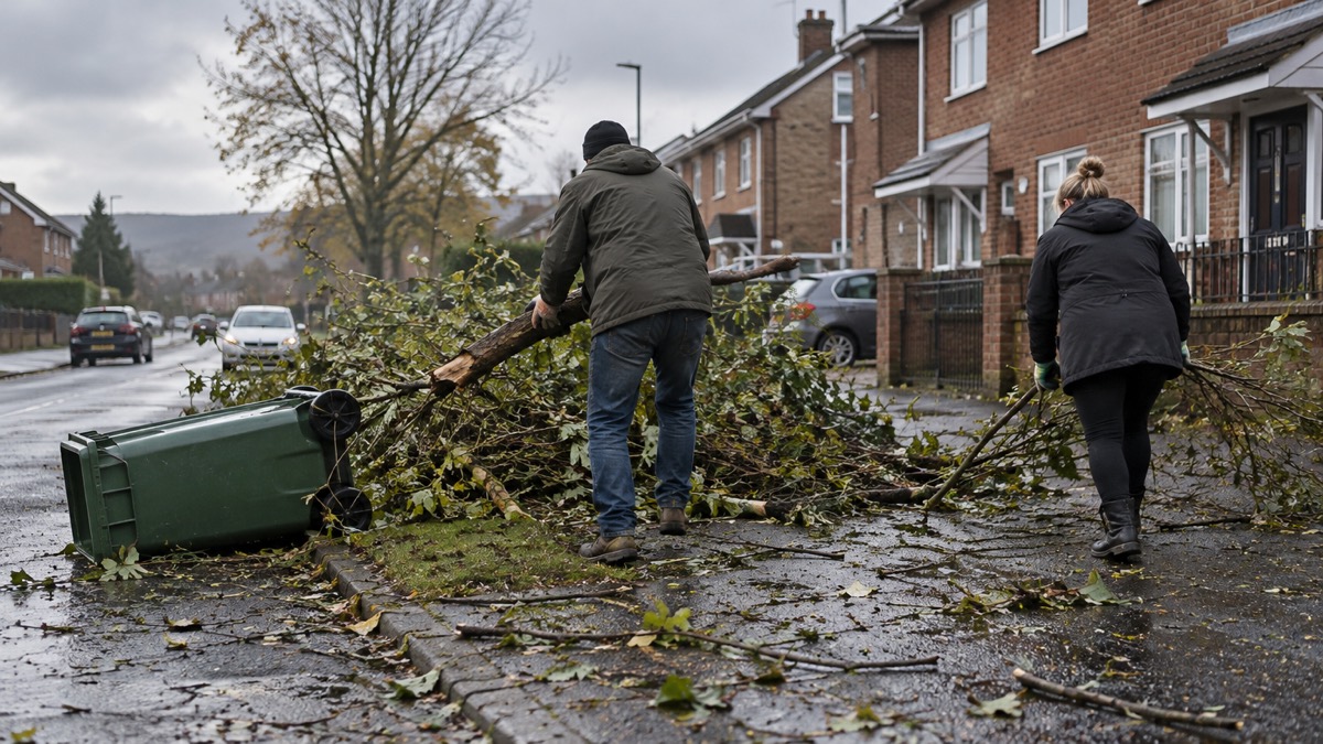
Storm Boelo was named by the Met Office on 22 October 2026 and reached the UK over the weekend of Saturday 24 and Sunday 25 October1. Amber warnings for wind were issued for Scotland and parts of Northern Ireland and northern England, with severe weather warnings updated so that the amber warnings covered Saturday night and Sunday2. Widespread gusts of 60 to 70mph were forecast within the warning area, with the potential for gusts of 80mph in exposed coastal locations2.
The storm's most visible impact was on electricity supplies in Northern Ireland, where the high winds caused damage to parts of the network and approximately 12,500 customers lost power in total3. By the evening of Sunday 25 October, NIE Networks reported that approximately 11,500 of those customers had been restored, with the hope that crews could restore power to all remaining properties that night, depending on the complexity of each repair3. The two figures come from the same update and are not fully reconciled in it, so treat both as approximate.
This page sets out what happened, area by area, how power was restored, and the practical steps to take during and after a storm like Boelo: travelling safely, staying clear of the coast, checking damaged trees, and knowing who to contact. If you want the broader picture of getting your household ready for wind and snow, start with our guide to storms, snow and ice.
How Storm Boelo was named and warned
The Met Office named Storm Boelo on 22 October 20261. Naming a storm is the signal that severe weather is expected to be disruptive enough that the public should act on it, and our page on how the Met Office chooses storm names explains the system. Boelo followed Storm Austen, the first named storm of the season, which brought strong winds to parts of the UK on the Friday before Boelo arrived2. Two named storms within days of each other is a useful reminder that a storm season can start quickly, and that preparing after the first storm may leave you exposed to the second.
The warnings themselves were issued in tiers. nidirect, the Northern Ireland government information service, reported amber and yellow weather warnings for strong winds on Saturday 24 October and Sunday 25 October, naming Storm Boelo as the cause5. The Met Office's news release confirmed that amber warnings for wind covered Scotland and parts of Northern Ireland and northern England, and that the amber warning sat within wider yellow warnings extending further south into England and north Wales and covering the whole of Northern Ireland2. Highland Council, preparing its own area, noted that the amber warning might affect exposed coastal areas, with the strongest winds initially in western Scotland spreading eastwards through Sunday4.
If you are unsure what the warning levels mean in practice, our page on Met Office weather warnings explains what yellow, amber and red ask of you.
The gusts forecast, and what they meant
Within the amber warning area, the Met Office forecast widespread gusts of 60 to 70mph, with the potential for gusts of 80mph in exposed coastal locations2. Outside the amber area, strong winds were also forecast to affect other parts of the UK, with gusts of 50 to 60mph possible in places2.
Those speeds matter because of what they can do. nidirect's warning for Storm Boelo listed the expected impacts plainly: injuries or danger to life from flying debris, large waves and beach material being thrown at coasts, travel delays, fallen trees, and power cuts5. Every one of those materialised somewhere during the storm, and the sections below deal with each in turn.
A further yellow wind warning followed for Tuesday 27 October, after the main storm had passed. Strong west to southwesterly winds were expected to spread across much of Scotland, the north of Northern Ireland and northern England, with gusts of 50 to 60mph possible quite widely and some coastal or exposed areas seeing gusts of 70mph or more6. That warning ran from 03:00 to 23:59 on Tuesday 27 October8. The lesson is that the end of a named storm is not always the end of the wind: check the forecast for a day or two afterwards before assuming it is safe to travel or to start clearing up.
| Warning | Area | When | Gusts |
|---|---|---|---|
| Amber, wind | Scotland, parts of Northern Ireland and northern England2 | Saturday night and Sunday, 24 to 25 October2 | 60 to 70mph widely, 80mph possible on exposed coasts2 |
| Yellow, wind | Further south into England, north Wales, and the whole of Northern Ireland2 | Weekend of 24 to 25 October5 | 50 to 60mph possible in places2 |
| Yellow, wind | Much of Scotland, the north of Northern Ireland and northern England7 | 03:00 to 23:59, Tuesday 27 October8 | 50 to 60mph quite widely, 70mph or more in coastal or exposed areas6 |
Where the storm hit hardest
The amber warning area tells you where the worst of the wind was expected: Scotland, parts of Northern Ireland and northern England, with the strongest winds starting in western Scotland and spreading eastwards through Sunday2. Traffic Scotland described Storm Boelo as bringing a very windy spell with some disruption likely across parts of northern UK9.
The clearest measured impact in the reporting was on Northern Ireland's electricity network, covered in the next section. Heavy rain added to the wind: the Met Office stated that heavy rain would provide an additional hazard, particularly in the north, bringing the potential for further impacts2. That combination of wind and rain is what brings down trees whose roots are sitting in saturated ground, and what turns minor surface water into standing water on roads.
For context, storms of this strength are not unusual in the northern UK, though each one bites in a different place. During Storm Caroline in December 2017, the strongest winds were across the north of Scotland, especially the Western and Northern Isles, where gusts exceeded 80mph10. Storm Aileen in September 2017 saw many areas of England and Wales record winds between 55 and 65mph, with the strongest gusts on the Isle of Wight10. And Storm Arwen recorded a highest gust of 98mph at Brizlee Wood in Northumberland11, a storm whose aftermath changed how network operators communicate with customers; our page on Storm Arwen covers that in detail.
Power cuts in Northern Ireland: about 12,500 customers affected
The high winds brought by Storm Boelo caused damage to some parts of the electricity network in Northern Ireland, with approximately 12,500 customers affected in total3. That figure comes from NIE Networks' own storm update of Sunday 25 October, and it counts the households and businesses that lost supply.
The same update set out the hope that crews would be able to restore power to all remaining properties that night, depending on the complexity of each repair3. That wording matters for anyone reading it: "the hope" is not a guarantee, and the complexity of each repair decides how long the last reconnections take. Both figures in the update are approximate.
If you are in Northern Ireland and want to check a power cut, NIE Networks publishes the latest information, including estimated restoration times for each fault, through Powercheck on its website3. You can also phone the NIE Networks Customer Helpline on 03457 643 64312. Powercheck is the quicker route for most people, because it shows the estimated restoration time without waiting in a call queue, and it is the first place to look during any future storm in Northern Ireland.
For comparison with an earlier storm in a different network area: when Storm Jocelyn brought strong winds overnight in January 2024, Northern Powergrid reported disruption to power supplies and was working to restore 1,700 customers without power13. Boelo's Northern Ireland figure of around 12,500 was therefore a substantially larger event for the network affected, though well short of the biggest storms of recent years.
How power was restored after Storm Boelo
Restoration after a storm is a sequence, not a single event. Crews first make safe the damaged parts of the network, then repair and reconnect, starting where a single repair restores the most customers. NIE Networks' Sunday evening update captures that process in motion: 11,500 of roughly 12,500 affected customers restored, with the remainder hoped for that night, each depending on the complexity of the repair3. "Complexity" is the operative word: a fallen tree on a line in an accessible field is a quicker fix than damage on difficult terrain, and the last few hundred reconnections routinely take the longest.
The same pattern shows in other events. When Heathrow Airport lost power in March 2025, power was restored to all of Heathrow's terminals by 10:56, and re-energisation of the wider network was completed by 14:2314. The terminals came back first because they were the priority load; the wider network followed. Households should expect the same ordering after any storm: hospitals, water treatment and other essential services are reconnected first, then the largest numbers of customers, then the outliers.
While you wait, the practical steps are on our power cuts page: keep fridges and freezers closed, use torches rather than candles, and check on neighbours who may need help. One lesson from previous storms is worth repeating here. Ofgem's report on customer experiences of Storm Arwen found that during extended outages there was no electricity to power fixed broadband and, typically, no or very low mobile signal due to storm damage to telecoms networks; a number of people with landlines also lost the use of them because they had been transferred from analogue to digital networks, which rely on electricity15. In plain terms: you cannot assume your phone will work in a long power cut, so a battery radio and a charged power bank are worth having before the storm, not after.
Further power cuts after the storm passed
Storm Boelo's effects did not stop at the Northern Ireland boundary or at the weekend. UK Power Networks, which operates in parts of eastern and southeast England, stated on 26 October that it was continuing to respond to the impact of Storm Boelo across areas of its network16. So even households well outside the amber warning area could find themselves off supply while operators worked through wind damage.
If your power goes off, whoever your operator is, call 105. That is the free, national power cut number that connects you to your local network operator, and Dorset and Wiltshire Fire and Rescue Service lists it as the number to call for a power cut, alongside 999 if there is doubt about immediate danger17. You can report a power cut and get an estimated restoration time in one call. Our staying informed page covers the other ways to keep in touch when networks are down.
After the storm has passed, check your own property for damage and make sure any damage is secured, when it is safe to do so18. Be careful not to touch any electrical or telephone cables that have been blown down or are still hanging18. A wire that looks dead may not be. Report hanging or fallen cables to your operator via 105, or to the emergency services on 999 if they present an immediate danger17.
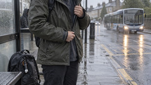
Travelling during and after Storm Boelo
The consistent official message during Boelo was to check before you travel and amend plans if necessary. Traffic Scotland advised giving yourself the best chance of avoiding delays by checking road conditions if driving, or bus and train timetables, and amending travel plans if necessary9. Lancashire's local resilience forum advice goes further for the height of a storm: avoid non-essential travel, and if you must travel, allow extra time19.
If you do have to travel in a storm, the Scottish Government's Readiness campaign sets out the preparation that matters:
- Plan ahead and allow extra time for your journey20
- Tell someone your destination and when you plan to arrive20
- Pack an emergency kit and charge your phone before you go20
- Have one or more emergency contact numbers on your phone or in your bag20
The same advice applies if flooding accompanies the wind, as it can when heavy rain follows, as it did with Boelo in the north2. South Wales Fire and Rescue Service's advice for adverse driving conditions is to check the forecast and road conditions before setting out22, and North Yorkshire Fire and Rescue Service advises slowing down and allowing additional time for your journey in heavy rain23. In Scotland, you can check whether your public transport is affected at Traveline Scotland online or by phone, or check directly with your operator20.
On foot, the advice is simple: if you do go out, try not to walk or shelter close to buildings and trees18. Cornwall Council adds to avoid parks, woodlands and other tree-covered areas during unsettled weather, to keep clear of damaged trees, and not to stop beneath tree canopies24. For driving specifically in gusts, see our page on how to drive safely in strong winds, and for the wider picture of cancellations and closures, trains, buses and bridge closures in bad weather.
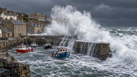
Staying safe on the coast in stormy seas
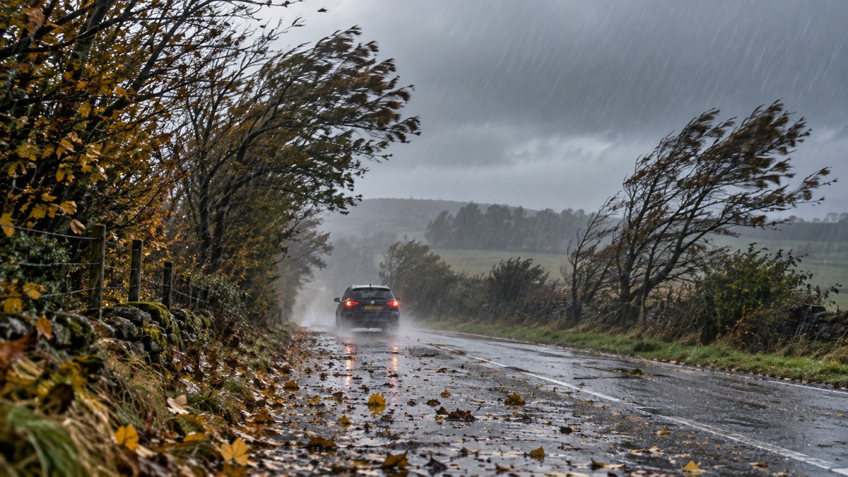
The Met Office's warnings for Boelo carried a direct coastal safety message, repeated across its warning pages. It is worth quoting in full, because every word of it is an instruction:
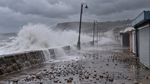
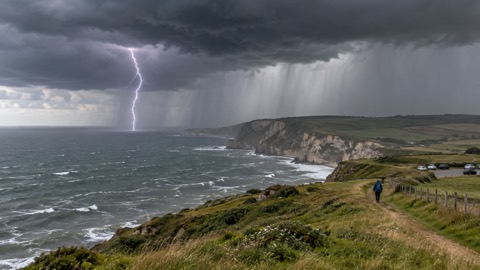
The Met Office's news release for Storm Boelo added the same three points in shorter form: stay away from cliff edges, stay back from stormy seas, and if you see someone in trouble, call 999 and ask for the Coastguard2. Cornwall Council's storm advice is to stay well away from the coast and the water's edge in extremely strong winds24, and North Yorkshire Fire and Rescue Service repeats the warning about large waves, even from the shore, sweeping people off their feet23.
The reason for the repetition is that this is the most common way storms kill people who are not in buildings. Waves breaking on a sea wall or at the foot of a cliff travel much further than they appear to, and the ground beneath them is wet and slippery. Keep dogs on a lead because a dog chasing to the water's edge is one of the most frequent reasons owners end up in the water. Our page on staying safe on the coast in gales and high waves covers this in more depth.
Storm-damaged trees near roads: what landowners should check
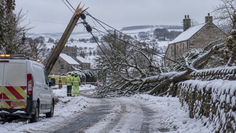
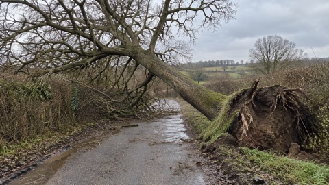
After the high winds from Storm Boelo, The Highland Council encouraged landowners to check trees and vegetation near public roads which may have been damaged4. This is not a bureaucratic request: a tree cracked by a storm can stand for days before it fails, and a tree leaning over a road or pavement after a gale is a hazard that grows rather than shrinks with time.
If you own trees, the practical sequence after a storm is:
- Wait until it is safe: avoid all work at height while conditions are still unsettled25.
- Check trees near roads, paths and buildings for cracks, leaning trunks and hanging branches4.
- Prune regularly as routine maintenance, and contact a tree surgeon if the trees are your own and extensive work is required26.
- If a hazard is presented by trees on public property, contact the local authority rather than dealing with it yourself26.
For everyone else, the message is to keep clear of damaged trees and not to stop beneath canopies24, and to report a tree blocking a road, which our page on how to report a fallen tree blocking a road explains. If you want to know who is legally responsible for a dangerous tree, see dangerous trees: who is responsible and how to report one.
Who to contact after Storm Boelo
The right contact depends on what has gone wrong. Traffic Scotland's advice for Boelo was to heed all advice from the Met Office, Police Scotland and Transport Scotland9.
| What has happened | Who to contact |
|---|---|
| Power cut, anywhere in the UK | Call 10517 |
| Power cut in Northern Ireland | NIE Networks Customer Helpline, 03457 643 64312, or Powercheck on the NIE Networks website24 |
| Immediate danger to life, including from storm damage | Call 999; Dorset and Wiltshire Fire and Rescue Service's rule is "if in doubt, call 999"17 |
| Someone in trouble at the coast | Call 999 and ask for the Coastguard2 |
| A hazardous tree on public property | Contact the local authority26 |
| Cleaning up after flooding | Contact your local environmental health department for further advice26 |
The "if in doubt, call 999" rule deserves emphasis, because people hesitate during storms. A hanging power line, a smell of gas, or a tree across a road in the dark are all 999 matters. The fire and rescue service would rather attend and stand down than be called too late17.
Earlier storms this season, and what Boelo tells you about the next one
Storm Boelo was the second named storm of the 2026 season, following Storm Austen, the first named storm, which brought strong winds to parts of the UK on the Friday before Boelo arrived2. Two storms in a week is a pattern worth preparing for: if your preparations were "get round to it after the first storm", Boelo arrived before that weekend was over.
Looking back at other seasons shows how variable the opening of a storm season can be. Storm Amy in October 2025 brought amber warnings and very strong winds to northern and western areas of Scotland, with the amber warning for northern areas running from 0000 to 2100 on the Saturday27. Storm Chandra in January 2026 brought an amber warning for wind to eastern Northern Ireland, with gusts of 60 to 70mph likely and 75mph possible near the coast, and a separate yellow wind warning covering Cornwall, southwest Wales and parts of northern Devon25. The common thread is that the amber areas move around: no part of the UK is reliably outside the wind zone, so the preparation is the same everywhere.
That preparation is set out across this site: preparing your home and garden for high winds, the emergency kit a household should keep ready, and backup power if you want to know what a power station or generator can and cannot do for you. The households that came through Boelo with the least trouble were the ones that had torches to hand, phones charged before the wind arrived, and a plan for checking on neighbours when the power went down.
Sources (27)
- UK storm centre, Met Office, 2026
- Amber warning issued for Storm Boelo as Storm Austen moves through, Met Office, 2026-10-24
- Get the latest news updates from your network company | Northern Ireland Electricity Networks, NIE Networks
- Ready for winter, The Highland Council, 2026-10-23
- Strong winds weather warning: information and advice, nidirect, 2026-10-24
- UK weather warnings, day 2, Met Office, 2026-10-24
- Accessible UK weather warnings, Met Office, 2026-10-24
- Accessible UK weather warnings, Met Office, 2026-10-24
- Disruption and travel advice, Traffic Scotland, 2026-10-29
- UK storm season 2017-18, Met Office, 2017
- UK storm season 2021-22, Met Office, 2026-10-29
- Ice weather warning: information and advice, nidirect, 2026-02-16
- Majority of customers affected by Storm Jocelyn now have power restored, Northern Powergrid, 2024-01-24
- Heathrow power restoration report, National Energy System Operator, 2025-03-21
- Customer experiences of Storm Arwen, Ofgem, 2022-06-09
- Power cut information and live updates: Hertfordshire, UK Power Networks, 2026-10-26
- Who to call for storm damage, Dorset and Wiltshire Fire and Rescue Service, 2022-08-03
- Strong winds and heavy rain warning: information and advice, nidirect, 2026-01-27
- Storms and gales, Lancashire Prepared, 2026-10-29
- Storms and wind: be ready, Scottish Government Readiness campaign, 2026-03-24
- Flooding: be ready, Scottish Government Readiness campaign, 2026-03-24
- Adverse driving conditions, South Wales Fire and Rescue Service, 2026-08-28
- Keeping safe during high winds and heavy rain, North Yorkshire Fire and Rescue Service, 2024-01-22
- Storm preparation advice, Cornwall Council, 2026-10-29
- Met Office Storm Chandra WeatherReady advice, Met Office, 2026-01-26
- Be prepared: severe weather and emergencies, Lancaster City Council, 2026-10-26
- Amber and yellow warnings in force for Storm Amy, Met Office, 2025-10-04
 Flood Warning Checklist
 First Steps After a Flood
 Insurance Claim Records
 Storm Arwen 2021
 Coastal Safety in Gales
 Council Help in Severe Weather
 Dangerous Trees
 Storm Darragh 2024
 Landslips After Heavy Rain
 Lightning Safety
 How Storms Are Named
 Travel Disruption in Bad Weather