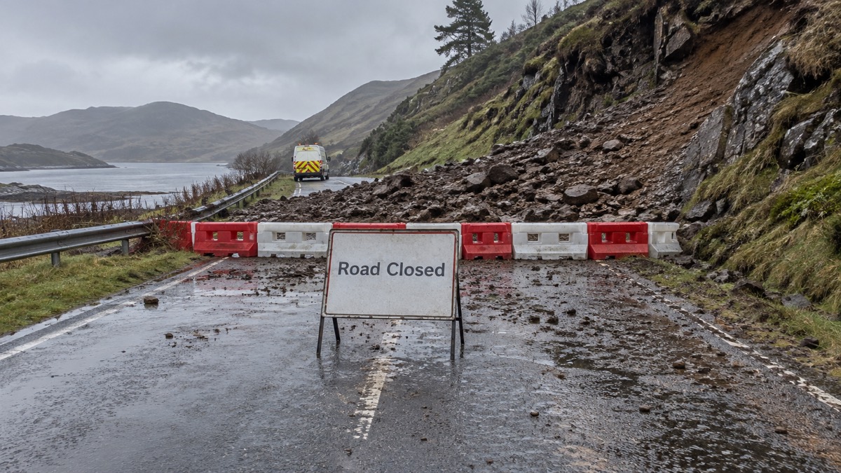
Landslips are most likely to happen when prolonged rain saturates the ground. Flooding is usually a consequence of a prolonged period of rain or heavy downpours, and it can be made worse by saturated ground, blocked drainage systems and neglected culverts1. Intense and prolonged storms can exceed the capacity of the local drainage system or saturate the ground, putting many more areas at risk than those on the natural flood plain2. When soil and rock on a slope can absorb no more water, the material above it can move, and that is when a landslip, also called a landslide or debris flow, happens.
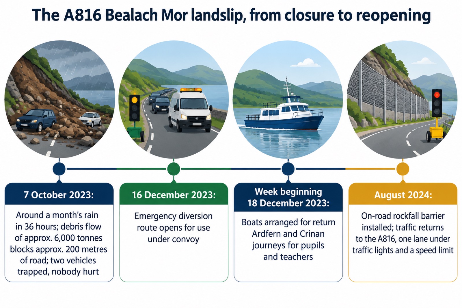
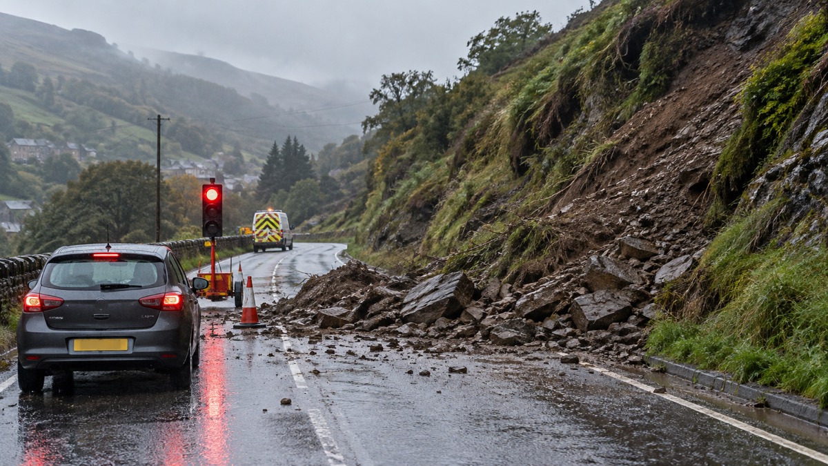
The clearest recent UK example is the A816 at Bealach Mor, near Ardfern in Argyll. On Saturday 7 October 2023, around a month's worth of rain fell in a 36 hour period across a number of areas of Argyll and Bute3. The result was a debris flow of approximately 6,000 tonnes of material that blocked the road over approximately 200 metres, trapping two vehicles, fortunately with nobody hurt3. The road did not fully reopen to its old route: an on-road rockfall barrier installed in 2024 allowed traffic back onto the A816, one lane at a time under traffic lights and a speed limit3.
This page explains why saturated ground leads to landslips, what to do when heavy rain warnings are issued, how to stay safe around floodwater and closed roads, and what the A816 and other closures tell you about how long these events last and how roads are made safe again. For the wider picture of severe weather, see our guide to storms, snow and ice.
Why prolonged rain saturates the ground and triggers landslips
A landslip needs two things: a slope, and water that the ground can no longer hold. Flooding is usually a consequence of a prolonged period of rain or heavy downpours, and it can be exacerbated by saturated ground, blocked drainage systems and neglected culverts1. Intense and prolonged storms can exceed the capacity of the local drainage system or saturate the ground, affecting areas well away from the natural flood plain2. That is why landslips can affect roads and properties that have never flooded before: the water is not rising from a river, it is moving through and over the ground itself.
The way water behaves depends on the ground it lands on. In rural environments, surface water flooding can happen naturally when heavy rain exceeds the soil's infiltration rates and flows as runoff overland7. In urban and paved areas, impermeable surfaces allow little or no infiltration, and local drainage systems cannot cope with the amount of rainfall7. Heavy rain falling on hard surfaces overwhelms drainage and sewers, and this type of flooding is more likely during intense summer storms but can happen all year round8. Summer flooding is often triggered by intense or prolonged rainfall falling on dry, compacted ground that is less able to absorb water9.
Groundwater adds a slower danger. Groundwater flooding is most likely in areas with underlying permeable rocks, called aquifers, which can be regional in scale, such as large areas of chalk or sandstone, or more local in scale10. It is most likely to happen in areas where the ground contains aquifers11, and the flooding it causes can persist for days, weeks or even months after heavy or prolonged rainfall12. That persistence matters for landslips: a slope can stay waterlogged long after the rain has stopped, so the risk does not end when the sky clears.
A month's rain in 36 hours: what triggered the A816 landslips
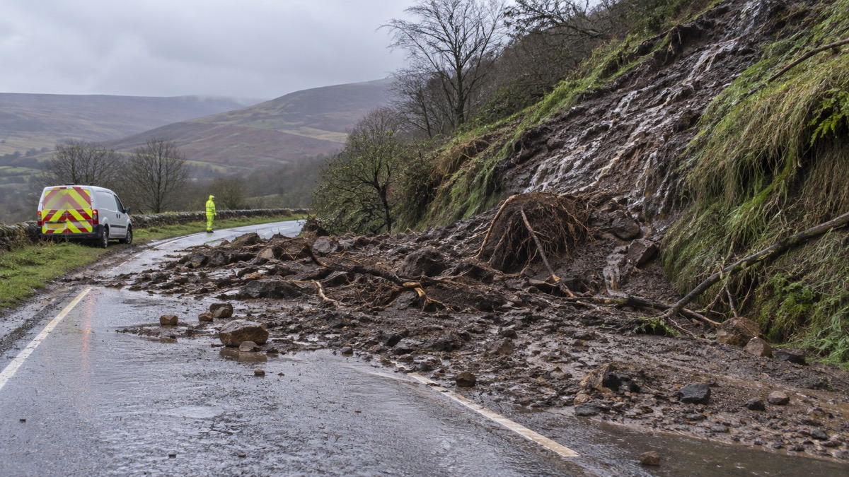
On Saturday 7 October 2023, a significant weather event brought around a month's worth of rain in a 36 hour period to a number of areas across Argyll and Bute3. That single figure, a month's rain in 36 hours, is the clearest illustration of the saturation problem: ground that would normally absorb a month's rainfall spread over weeks had to cope with it in a day and a half.
The rain did not fall on one road only. The same event brought down debris flows on the A83 and A815, which together accounted for approximately 6,000 tonnes of material, compared with approximately 13,000 tonnes at Ardfern3. At the A816, south of Kintraw, a significant debris flow, often referred to as a landslide, brought approximately 6,000 tonnes of material down the hillside, blocking the road over approximately 200 metres3. Two vehicles were trapped in the landslip; fortunately nobody was hurt3.
Events like this are not confined to the west of Scotland. On the Dorset coastline, rock fall and landslide are naturally occurring events all the way along the coast, and they can happen at any time of year, although their frequency and impact can be linked to very wet weather during winter and spring and very dry weather over the summer13. In Ironbridge Gorge in Shropshire, landslips have been happening for hundreds of years, with gradual land slippage caused by the underground geological structure, ongoing erosion and past mining14. The lesson for any household is the same: if you live below or beside a slope, prolonged rain is the condition to watch.
What to do when heavy rain warnings are issued
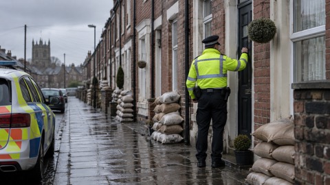
When the Met Office issues a heavy rain warning, act before the rain arrives. Check if your property is at risk of flooding, and if it is at risk, prepare a flood plan and an emergency flood kit6. You can sign up to Met Office weather warnings so you hear about them early15, and our guide to Met Office weather warnings explains what yellow, amber and red mean for what you should do.
Your flood plan should consider where to relocate your car when a flooding incident is possible16. When flooding is forecast, the Scottish Environment Protection Agency advises: keep your mobile phone fully charged, move your vehicle out of the flood risk area, move important documents and valuable items to a safe place, make sure all flood protection products are in place and working correctly, move pets and animals to a safe place with enough food and water, and check on your local community17. During a flood, move vehicles to higher ground18, and if the emergency services tell you to evacuate, leave the area19.
Your emergency flood kit should include a battery powered or wind-up radio16, so you can follow updates if the power or mobile networks are affected. See our emergency kit guide for the full list of what a UK household should keep ready.
A few simple jobs around the home reduce the local risk. Removing leaves and debris covering the top of your grids helps prevent blockages which could cause localised flooding in heavy rainfall4. When a severe weather warning is issued, secure loose objects such as ladders and garden furniture, close and securely fasten windows, particularly on the windward side, and large doors, and park vehicles in a garage if available, otherwise clear of buildings, trees, walls and fences22. If thunderstorms are forecast, park your car outside the flood zone23, and keep away from underground or low-lying spaces such as car parks, basements or underpasses, which might flood rapidly24.
Floodwater and fast-flowing water: never drive, walk or swim through it
The instruction is the same from every official body in the UK, and it is absolute. Do not walk, drive or swim through flood water17. Do not walk or cycle through standing or flowing flood water: even shallow, fast-flowing water can knock you over or move a vehicle during a flood21. Avoid driving or walking through flood water, because there may be hidden dangers18. Never drive through flood water; always find an alternative route5.
The numbers explain why. Never drive through flowing water that is more than 10cm deep4. Two feet, or 60cm, of rushing water will carry most vehicles away5. Vehicles can be swept away in just two feet of water, and the water may be deeper than it looks and faster moving, with hidden dangers such as open drains or debris25. Never walk or drive through flood water: there may be underwater hazards, and it may be deeper than it appears14.
"Never try to swim through fast flowing water or floodwater, you may get swept away and you also don't know what items lay beneath the surface."
If you are affected by fast flowing or deep water, the Met Office advice is plain: it is not safe to drive or walk or swim through floodwater, avoid it where possible, and if you are affected by fast flowing or deep water call 999 and wait for help6. West Midlands Ambulance Service is equally direct about entering floodwater: avoid this at all costs20.
Driving in heavy rain carries its own risks even before flooding. Aquaplaning, where your tyres lose contact with the road on a film of water, is more likely at higher speed and if you accelerate suddenly, according to Mid and West Wales Fire and Rescue Service, for whom heavy rain is a common event, especially in autumn and winter27. Our guide on how to drive in heavy rain and avoid aquaplaning covers this in detail. Devon and Somerset Fire and Rescue Service, whose rescues often involve people in water, advise sticking to the speed limits and never using your mobile phone when driving28.
When to call 999 and when to call NHS 111
Call 999 if you are in immediate danger29. That includes being trapped by floodwater or affected by fast flowing or deep water: call 999 and wait for help6. If your vehicle is caught in flood water and you can get out, shout and sound your horn for help, and as soon as possible after leaving the vehicle call the emergency services26.
For health concerns that are not immediately life threatening, ring NHS 111 if you are worried about your health or that of somebody you know6. The NHS gives specific guidance for falls, which are a real risk in and around flooded streets: get help from NHS 111, by calling 111 or online, if you or someone else has fallen and may be in pain, injured or unwell30. Call 999 if someone who has fallen may have injured their head, back, neck or hip30. See our first aid guide for what to keep at home.
| Situation | Who to call |
|---|---|
| Trapped by floodwater, or affected by fast flowing or deep water | 999, then wait for help6 |
| In immediate danger of any kind | 99929 |
| A fall where the person may be in pain, injured or unwell | NHS 111, by phone or online30 |
| A fall with possible head, back, neck or hip injury | 99930 |
| Worried about your health or someone else's during severe weather | NHS 1116 |
Road closures and diversions after a landslip
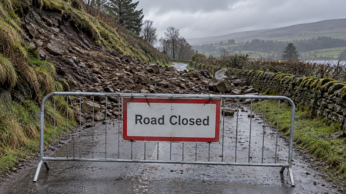
When a landslip blocks a road, the closure can last months, not hours. At the A816, the emergency diversion route did not open until 16 December 2023, more than two months after the landslip, and it operated under convoy3. Traffic did not return to the A816 itself until August 2024, when an on-road rockfall barrier allowed one lane to operate with a traffic light system under a speed limit3. Plan on that timescale if a landslip closes a road you rely on, and check the council's own pages for the current arrangement.
Some councils use physical closure gates at known flood points. In Somerset, emergency road closure gates are kept locked open at all times and only locked shut when water levels are rising and the road is at risk of becoming impassable25. They are only closed during daylight hours, which means gates may be shut before a road becomes flooded if there is a risk it will become flooded overnight25. The warning that comes with them applies to any closure: driving in floodwater is extremely dangerous, vehicles can be swept away in just two feet of water, the water may be deeper than it looks and faster moving, with hidden dangers such as open drains or debris, and ignoring a road closure sign or gate can invalidate your insurance25.
Closures have knock-on effects beyond drivers. On the Dorset coastline, cliff falls have caused disruption to tourism as a result of cliff walks being closed where the cliff has fallen13. For further information on cliff falls or landslides in your area, check the local press and social media for any reported events13. For rail, bus and bridge closures in bad weather generally, see our guide to travel disruption.
Bealach Mor: 6,000 tonnes across 200 metres of road
The scale of the A816 landslip is worth understanding, because it shows what councils are dealing with and why closures last so long. At the A816, south of Kintraw, approximately 6,000 tonnes of material came down the hillside, blocking the road over approximately 200 metres3. Rocks were precariously perched on the hillside above the cleared road, with the largest being over 200 tonnes, and some as high as 120 metres above the road3.
Clearing it was a major engineering job. Argyll and Bute Council cleared more than 15,000 tonnes of material in total3. The council made an agreement with Forestry and Land Scotland to dispose of material at a former quarry site nearby, where it will be used to restore the quarry3. Boulders from the hillside are being used to form a bund at the side of the road as part of the protective measures, so they are not for sale3.
| A816 Bealach Mor landslip | Figure |
|---|---|
| Rainfall that triggered it | Around a month's worth in 36 hours, 7 October 20233 |
| Material blocking the road | Approximately 6,000 tonnes over approximately 200 metres3 |
| Largest boulder | Over 200 tonnes3 |
| Height of perched rocks above the road | As high as 120 metres3 |
| Total material cleared | More than 15,000 tonnes3 |
| Vehicles trapped | Two, with nobody hurt3 |
| Emergency diversion route opened | 16 December 2023, under convoy3 |
| Traffic returned to the A816 | August 2024, one lane under traffic lights and a speed limit3 |
Keep away from landslip sites until they are made safe
The single most important safety rule at a landslip site is to stay away. Argyll and Bute Council's overall view was that the Ardfern site carries a significant level of risk and is therefore not suitable for public access until protective measures are in place3. Rocks perched 120 metres above a road are not stable scenery: they are the reason the site is closed.
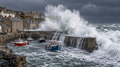
The same caution applies to the coast. On the Dorset coastline, rock fall and landslide are naturally occurring events all the way along the coast, and the areas in BCP Council where cliff falls have happened most are the coastline between Sandbanks in Poole and Hengistbury Head in Christchurch, including areas in Bournemouth by the Pier Approach and down to Boscombe13. Dorset's current assessment rates rock fall and landslide on the Dorset coastline as low risk31, but low risk is not no risk, and events can happen at any time of year13. If you are on the coast in bad weather, see our guide to staying safe on the coast in gales and high waves.
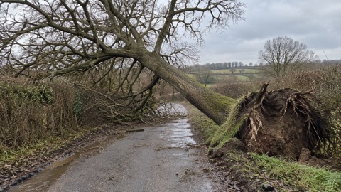
Around your own home, the same principle applies to structures. Keep away from the sheltered side of boundary walls and fences, as if these structures fall they will collapse on this side22. That advice is given for storms, but it holds for any ground that is waterlogged and moving.
How monitoring and rockfall barriers let roads reopen
Roads do not reopen simply because the debris has been shifted. At Bealach Mor, the hillside will be remotely monitored for water and saturation levels, and for rain that is forecast3. Recent works to install an on-road rockfall barrier allowed traffic to be moved back to the A816 at Bealach Mor, with one lane operating under a traffic light system and a speed limit3. The barrier and the monitoring together are what make the road safe enough to use, and the speed limit and lights are part of that safety system, not an inconvenience to be ignored.
The B8035 at Gribun on the Isle of Mull shows how long the full process can take and how risk is assessed. There, three recent rock falls caused significant damage to the road surface, the safety barrier and the hillside itself32. The road was closed with an elevated risk of additional rockfall along the closed section given the poor weather forecast for the next seven days, with Yellow Warning rainfall events forecast32. A later assessment confirmed that the likely frequency of rockfall events poses a risk level probably on the boundary of the Tolerable and Unacceptable regions, likely to move into Unacceptable under certain conditions; for a high frequency of events, for example 10 blocks per year, journeys would need to be reduced to below 20 journeys per day for single occupancy vehicles to reduce the risk to within the ALARP region32. Once the geotechnical works are completed, local road teams will carry out final road repairs and barrier restoration to enable the road to safely reopen32.
School transport and daily life during a long closure
A closure of months changes daily routines, and councils adapt. During the A816 closure, Argyll and Bute Council arranged boats for return Ardfern and Crinan journeys for pupils and teachers, continuing in the week beginning 18 December, with remaining seats bookable free of charge with Venture West3.
The general rules elsewhere are worth knowing. In the Scottish Borders, school transport not running does not automatically mean the school is closed: it is up to parents to decide if they consider it safe to transport their child to school, and if they do, they will also need to collect them at the end of the school day33. For children and young people who access additional needs transport, if an individual route is affected, cancellations or changes to routes will be communicated directly to families33. In Northumberland, in extreme weather a school may close and your child may be sent home early, and updates on school closures and transport disruption are issued via the council's alerts page34. Our guide on how to find out if your child's school is closed covers this in more detail.
For ongoing issues with traffic management during the A816 works, Argyll and Bute Council gives a contact number: phone 07400 0330463. If you need to call it, stop safely first: never use your mobile phone when driving28.
If a vehicle is caught in a landslip or floodwater
The A816 landslip trapped two vehicles, and fortunately nobody was hurt3. If the worst happens, the sequence that official advice gives is simple. If you are trapped in a vehicle in flood water, shout and sound your horn for help26. As soon as possible after leaving the vehicle, call the emergency services for help26. If you are affected by fast flowing or deep water, call 999 and wait for help6.
Do not attempt to recover the vehicle yourself through moving water. Never try to swim through fast flowing water or floodwater: you may get swept away, and you also don't know what items lay beneath the surface26. Even shallow, fast-flowing water can knock you over or move a vehicle21. The vehicle can be dealt with once the water has dropped and the emergency services say it is safe.
Winter weather adds a further hazard on the roads after rain. Road surfaces are often wet and covered in frost, ice or snow, but this does not occur uniformly: a road will often have isolated patches of frost or ice after most of the road has thawed, and this commonly occurs under bridges35. Braking on an icy or snow covered bend is extremely dangerous, as the centrifugal force will continue to pull you outwards and the wheels will not grip well, which could cause your vehicle to spin35. See our guides on driving in snow and ice and what to do if you hit black ice.
Getting ready before the next prolonged rain event
The climate context is that the emergency is not going away: the climate emergency means there will be more regular and intense periods of rainfall, which will increase the likelihood of flood events29. Households can prepare for that in ordinary ways, and most of the preparation is the same whether the threat is floodwater, a landslip or a long road closure.
- Sign up to Met Office weather warnings15, and know what the warning levels mean36.
- Check if your property is at risk of flooding, and prepare a flood plan and an emergency flood kit6.
- Include a battery powered or wind-up radio in the kit16.
- Consider where to relocate your car when a flooding incident is possible16.
- Keep your mobile phone fully charged when flooding is forecast17.
- Remove leaves and debris from the tops of your grids to prevent blockages in heavy rainfall4.
- Check on your local community when flooding is forecast17.
For the wider picture of household preparedness, start with our getting started guide, and for flooding specifically, see our flooding guide.
Sources (36)
- Preparing for a flood, Nottinghamshire County Council
- Flooding in Derbyshire, Derbyshire County Council
- A816 Bealach Mor Landslip, Ardfern, Argyll and Bute Council
- Flooding support, Lancashire County Council
- Preparing yourself for flooding incidents, Greater London Authority
- Stay safe in heavy rain, Met Office
- Surface water flooding, Derbyshire County Council
- Surface water flooding, Greater London Authority
- Hot Weather Toolkit 2025, NHS Humber and North Yorkshire Integrated Care Board, 2025
- Groundwater flooding, Derbyshire County Council
- Types of flooding and who to contact, St Helens Borough Council
- National assessment of flood and coastal erosion risk in England 2024, Environment Agency, 2024
- Rock fall and landslide, Dorset Prepared, 2025
- West Mercia Risk Register, West Midlands Ambulance Service, 2025
- How to prepare for flash flooding, Greater London Authority
- Preparing for a flood, nidirect, 2025
- Before, during and after a flood, Scottish Environment Protection Agency
- During a flood, Nottinghamshire County Council
- Help during a flood, GOV.UK
- Staying safe in flooding, West Midlands Ambulance Service
- Flooding, Ready Scotland, 2026
- Be Prepared, Lancaster City Council
- Stay safe in a thunderstorm, Met Office
- Stay safe in thunder and lightning, Met Office
- Emergency road closure gates, Somerset Council, 2026
- Flood water is coming into my home, London Fire Brigade
- Yrru mewn glaw trwm, Mid and West Wales Fire and Rescue Service
- Top causes of rescues and how to avoid them, Devon and Somerset Fire and Rescue Service
- Be flood aware, Greater London Authority
- Falls, NHS, 2025
- Environment-related risks, Dorset Prepared
- B8035 Gribun rockfalls and road closure, Isle of Mull, Argyll and Bute Council, 2025
- Winter and gritting FAQs, Scottish Borders Council
- Information for parents during periods of severe weather, Northumberland County Council, 2026
- Winter preparedness, South East Coast Ambulance Service, 2025
- Severe weather advice, Met Office
 Flood Warning Checklist
 First Steps After a Flood
 Insurance Claim Records
 Storm Arwen 2021
 Storm Boelo
 Coastal Safety in Gales
 Council Help in Severe Weather
 Dangerous Trees
 Storm Darragh 2024
 Lightning Safety
 How Storms Are Named
 Travel Disruption in Bad Weather