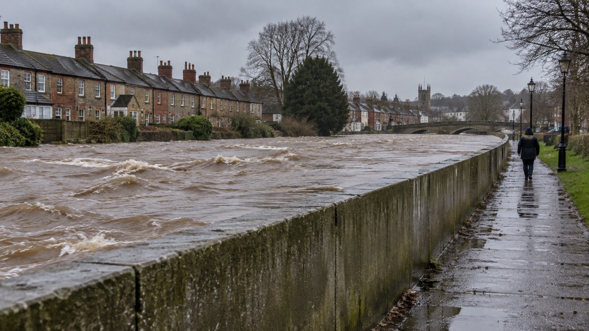
Flood defence schemes are the walls, embankments, storage areas, culverts and natural measures that stand between a river or the sea and the homes behind it. They range from a £15 million engineering project in a Scottish town to wooden "leaky dams" in an English brook, and they are the reason many households in high risk areas have never flooded. In England, the Environment Agency's National Flood Risk Assessment shows that 6.3 million properties are in areas at risk of flooding1, and flood and coastal defences protected around 167,000 properties2. In Scotland, 1 in 22 homes and 1 in 13 non-residential properties are at risk of flooding3.
But a scheme is not a guarantee. Defences are built to a "standard of protection", a level of flood they are designed to contain, and they can be overtopped or fail in more extreme conditions4. This page explains what schemes actually do for the homes near them, how to find out whether one exists or is planned for your community, how they are funded, and what help is available if you live outside one. If you want to start with your own property, see Checking Your Home's Flood Risk by Postcode.
What a flood defence scheme does for homes nearby
A flood alleviation scheme is a package of works built to reduce flood risk to a defined group of properties. What it means for your household is a lower chance of water reaching your door, not an absolute promise that it never will. Schemes are designed to a standard of protection: the Ammanford flood alleviation scheme in Carmarthenshire, for example, is designed to contain floods up to a 1% annual chance of occurrence, including an allowance for climate change8. In plain terms, that means the scheme is built to hold back a flood so large it has about a one in a hundred chance of happening in any given year, with extra capacity built in for a wetter future climate.
The scale of what schemes deliver varies enormously, and it is worth knowing the range. Some protect a street; some protect thousands of homes.
| Scheme | Location | What it protects |
|---|---|---|
| Godalming flood alleviation scheme | England | Approximately 90 homes9 |
| Ammanford flood alleviation scheme | Carmarthenshire | 223 properties10 |
| Stephenson Street scheme | Liswerry, Newport | 1,032 properties, with more than 1,100 homes and 1,000 non-residential properties better protected from tidal flooding once climate change is factored in11 |
| Counters Creek Flood scheme | London | 1,230 properties from basement sewer flooding9 |
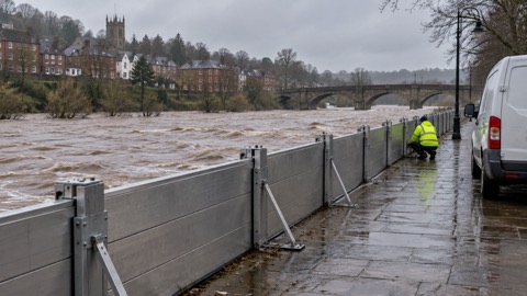
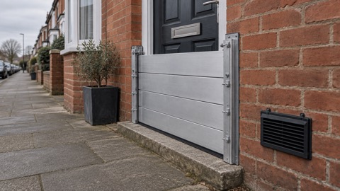
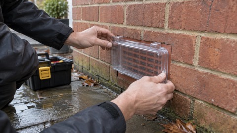
Two things follow from this for an ordinary household. First, if a scheme has been completed near you, your flood risk has genuinely changed, and it is worth rechecking the flood maps and your insurance position. Second, the protection is designed to a stated standard, and Natural Resources Wales warns that "flood defences can fail or be overtopped during extreme flooding conditions"4. A scheme reduces risk; it does not end it. That is why the official advice is always to combine any local scheme with your own household flood plan, which you can build with Making a Household Flood Plan, and with property-level protection such as door flood barriers and airbrick covers.
Finding out whether your community is a Potentially Vulnerable Area
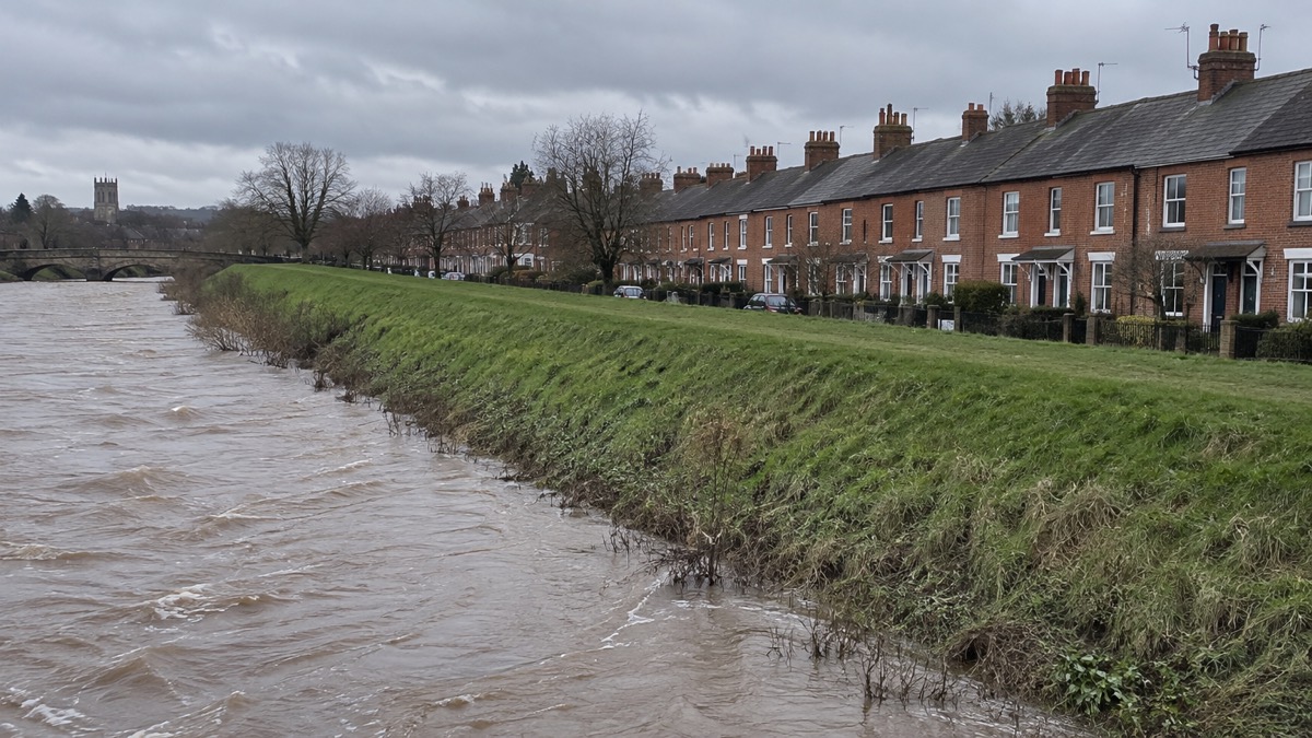
In Scotland, the starting point for finding out whether a scheme may come to your community is SEPA's Potentially Vulnerable Areas, usually called PVAs. These are "the parts of catchments and coastal areas where SEPA has identified that a nationally significant flood risk currently exists now or is likely to occur in the future"12. Where an area is designated a PVA, SEPA produces flood hazard and flood risk maps for it, objectives and actions are set in consultation, lead local authorities produce Local Flood Risk Management Plans, and Scottish Water assesses the risk of flooding from the sewerage system5.
The 2024 review changed how PVAs work. They were first identified in 2011 and updated in 2018, when there were 235 catchment scale areas. Following strong support in a public consultation, PVAs are now based on a community rather than a catchment scale, and there are now 452 community scale PVAs5. Together, these 452 areas cover 90% of the properties at risk of flooding in Scotland5. SEPA must review and update PVAs every six years under the Flood Risk Management (Scotland) Act 2009, and the next cycle of flood risk management plans, informed by these PVAs, is due to be published in 20275.
To check your own position, SEPA's advice for households at risk is to view the flood maps to see if your area is affected, sign up to Floodline, know who to contact if flooding happens, join a local flood group, respond to consultations, and keep up to date via SEPA and local authority websites5. SEPA's flood maps do not show individual properties, but they can tell you if your area is at risk13. Scotland is split into 19 flood alert areas, loosely following local authority and catchment boundaries, and there are 326 fluvial and coastal flood warning areas at community level14. There are also 14 Local Plan Districts, which SEPA and partners use to co-ordinate flood risk management across the country15. For how the alert and warning system works, see Flood Alerts, Flood Warnings and Severe Flood Warnings.
One point that catches people out: past flooding alone does not guarantee designation. SEPA is explicit that "the presence of a past flood on its own is not sufficient to classify the community as a community PVA"5. And if your community is not a PVA, you are not abandoned: national flood risk management actions still apply to people at risk of flooding outside the community PVAs, and local authorities can still take forward management of local flood issues outside PVAs5.
In England and Wales the equivalent starting point is different: check the Environment Agency's flood risk maps for your postcode, as Westminster City Council advises16, or contact your council for site specific information on surface water flood risk, as Derbyshire County Council suggests17. For Wales, see Wales: Natural Resources Wales Warnings and Risk Maps.
Living near a scheme under construction: the Campbeltown example
If a scheme is being built near you, the Campbeltown Flood Protection Scheme in Argyll shows what to expect. Campbeltown floods because, on the outskirts of the town, there are a number of steep catchment areas where rainwater pools, eventually overflowing and flooding nearby streets18. Argyll and Bute Council, which is responsible for the project, monitored the impact of flooding in the town over five years, investigated several options and held a number of public consultations, with the last two years of that period spent developing the preferred package of options18. Construction works commenced in September 2022, and the council expected the whole project to take around two years18. The scheme is a £15 million major engineering project to reduce the impact of flooding on residents and businesses, built in five parts, with the order of the parts being finalised18.
The funding split is typical of Scottish schemes: 80% funded by the Scottish Government and 20% funded by Argyll and Bute Council18. For updates, the council provides monthly updates at the end of each month, plus any other specific localised updates as necessary, for example for road closures18. If a scheme is under construction near you, look for the same things on your own council's website: a stated programme, a named responsible authority, and a regular update rhythm. In Northern Ireland, you can also get flood updates in local news, weather and traffic bulletins19.
Campbeltown also shows how schemes and property-level work now go together. The options appraisal identified a combined fluvial scheme combined with property flood resilience (PFR) as the most economically and technically viable option to boost the standard of protection from both fluvial and surface water flooding20. The Millknowe upstream storage area and culvert replacement at Dalaruan Street will reduce fluvial, or river, flooding during more frequent events, while PFR measures provide increased resilience during more extreme events; the fluvial scheme alone will not address frequent surface water flooding20. Residents can benefit from things such as flood gates, replacement anti-flood air bricks or covers, and waterproofing works18. Each PFR survey takes approximately 90 minutes, and some measures are installed within one hour with minimal interruption, with impacts likely to include low-level noise similar to minor works20. If your community is offered something similar, see Property Resilience Surveys and Professional Installation.
Natural flood management: leaky dams can cut flood peaks
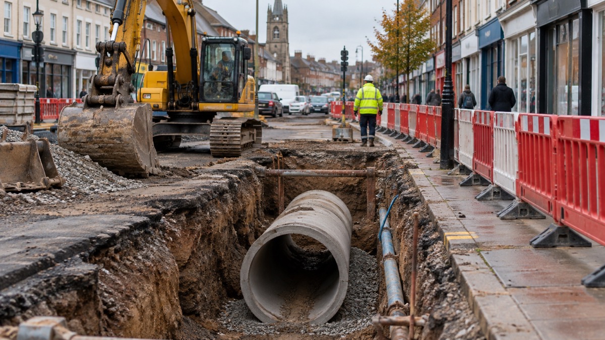
Not every defence is concrete. Natural Flood Management, or NFM, works by using natural processes to manage water flow, helping to absorb and slow down water in upper catchments, which reduces flood peaks downstream21. In practice this means features like leaky barriers, two-stage channels, earth bunds, wetlands and river restoration, all of which hold water high in a catchment for a few crucial hours so that the peak arriving at a town downstream is lower and slower.
A worked example is the Gotham NFM scheme in Nottinghamshire. Its key features include 60 leaky barriers made of wooden logs to imitate natural dams, two-stage channels for increased storage capacity and earth bunds21. Alongside it, a project to protect 86 properties from flooding along the Titchfield Park Brook catchment has been taken forward, and the county council also leads a Community Flood Signage Scheme21. NFM is generally delivered alongside, not instead of, traditional engineering: it suits rural upper catchments and complements walls and storage areas in towns.
NFM has had national funding behind it. A national NFM programme started in 2017 and was due to finish in 2021, with funding allocated to 58 projects9. A later national programme saw 40 successful packages of work announced by ministers in February 2024; three have subsequently withdrawn, and the remaining 38 will be carried out2. So if you hear about wooden dams appearing in a stream near you, it is likely to be one of these schemes, and it is a deliberate, funded flood defence measure rather than an obstruction.
NFM and property protection sit at opposite ends of the same catchment, and both matter. West Yorkshire's preparedness guidance notes that flash floods can cause walls of water 10 to 20 feet high, and lists options to protect your property such as flood gates or flood sacks, specialist doors and seals for airbricks22. Derbyshire County Council sets out four key strategies for defending your property: prevent water getting in, delay flood water from getting into the building, limit the damage to furniture, electricals, walls, floors, fixtures and fittings, and make it easier, faster and cheaper to clean up and recover17. For the products themselves, start with Protecting Your Home: Resistance and Resilience Measures.
Upstream storage areas: how the Skipton scheme protects 378 homes
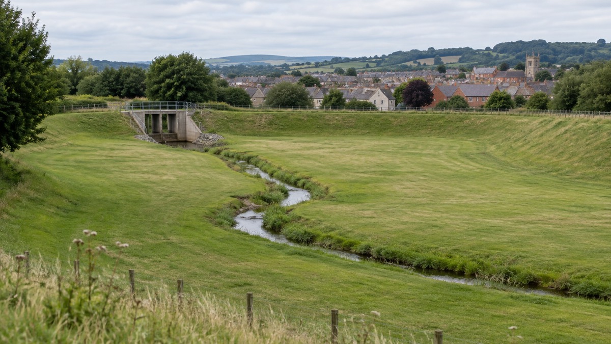
Upstream storage is one of the most common designs in modern flood alleviation schemes. Instead of trying to hold a river back at the town, the scheme gives it somewhere harmless to spread out upstream. The Skipton flood alleviation scheme, which opened in October 2018, involved the creation of 2 upstream water storage areas, and it will reduce flood risk for 378 homes and at least 165 businesses. When heavy rain raises the river, water is held in the storage areas and released slowly, so the peak flowing through the town stays below the level of the defences.
The same principle appears across the country. In Wales, major schemes in progress at Pwllheli, Porthmadog, Cardigan, the River Ritec at Tenby and in the Taff Catchment are expected to benefit over 3,000 properties when they are completed11. Completed Welsh schemes include the Stephenson Street scheme in Newport, which reduced the flood risk to 1,032 properties, with more than 1,100 homes and 1,000 non-residential properties better protected from tidal flooding taking account of future climate change, and approximately 2km of raised defences constructed11. A scheme at Sandycroft in Flintshire has increased the standard of protection to 218 properties11. In Carmarthenshire, the Ammanford scheme protects 223 properties10.
Storage areas change what you will see locally. Land that was fields becomes a designated flood storage area that fills during storms, and it may look like ordinary countryside for most of the year. If you live near one, the important things are to respect any signage about access during floods, and to understand that the storage area is doing the work your town's walls alone could not do.
England's investment programme and how schemes are funded
Flood defences in England are funded through multi-year government investment programmes, and the current picture is one of a large two-year settlement being followed by a longer programme. The UK government's £2.65 billion total investment for 2024/25 and 2025/26 is better protecting over 52,000 properties across England7. Building on that, the UK government will commence a new 10-year flood and coastal erosion investment programme, launching in April 2026, with £4.2 billion invested in flood and coastal erosion resilience over its first three years7. The government describes this as £4.2 billion for flood defences to build and maintain flood defences, protecting communities across England6.
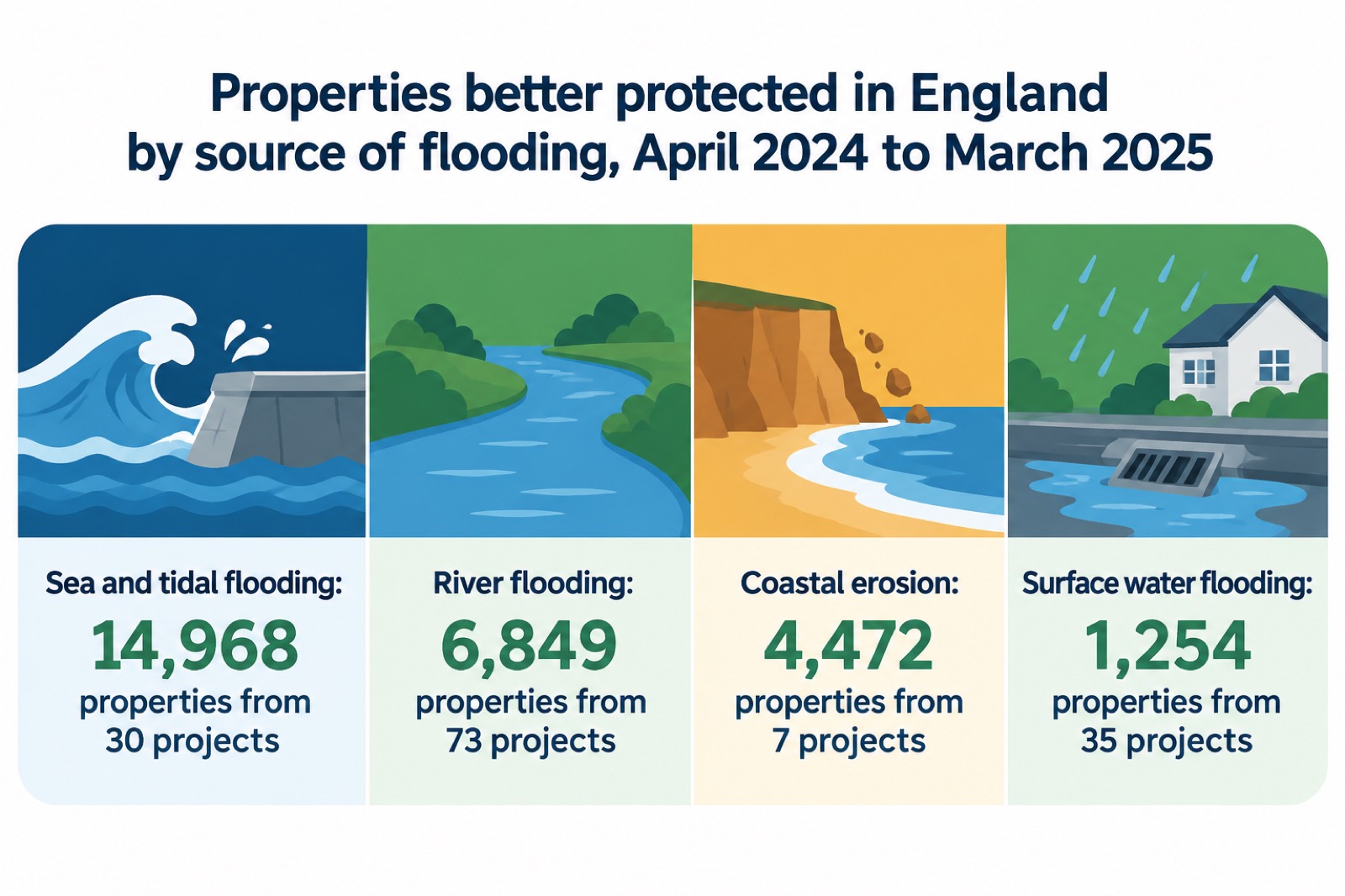
The results show up in the annual figures. Between 1 April 2024 and 31 March 2025, flood and coastal defences across the country protected around 167,000 properties2. In the same period, the breakdown of properties better protected by source was: sea and tidal flooding, 14,968 properties from 30 projects; river flooding, 6,849 properties from 73 projects; surface water flooding, 1,254 properties from 35 projects; and coastal erosion, 4,472 properties from 7 projects2.
Responsibility is layered. Surface water flooding is the responsibility of local authorities, designated as Lead Local Flood Authorities under the Flood and Water Management Act23. In Scotland, your local council is responsible for the construction and maintenance of any flood defences in your area13, and Scottish schemes are typically part funded by the Scottish Government, as at Campbeltown18. Flood risk management plans in Scotland show how flooding will be managed over a six year period in each area, including funding and the timetable for actions24. For who does what across agencies, councils and water companies, see Who Manages Flood Risk: Agencies, Councils and Water Companies.
The risk being managed is growing. In England, 163,300 properties are likely to flood to depths of 30cm or higher from rivers and the sea, over two fifths (44%) of all properties in areas at high risk, and 87,500 properties are in areas at high risk of flooding to depths of 60cm or higher, around 24% of all properties in high risk areas1. Looking ahead, 288,800 properties could flood to depths of 30cm or higher from rivers and the sea between 2036 and 2069, a 77% increase from the present day1. Regional concentration matters too: the East Midlands, Yorkshire and the Humber, and South East regions account for about half (52%) of the total number of properties in areas at high or medium flood risk from rivers and the sea, while less than 1 in 10 of properties in high and medium risk areas are in London, largely due to major flood defences such as the Thames Barrier1.
Coastal erosion and shoreline management
Coastal communities face a second threat alongside flooding: the loss of land to erosion. In England, Shoreline Management Plans (SMPs) set out a planned approach to managing flood and coastal erosion risk around the coast to 2105, with four approaches: hold the line, advance the line, managed realignment, and no active intervention1. Which approach applies to your stretch of coast determines whether defences will be maintained, extended, allowed to retreat in a managed way, or not actively defended at all.
The numbers are sobering even with the plans in place. Even with SMPs completed, there could be 19,700 properties at risk of coastal erosion in the period up to the end of the plans, with climate change1. A previous assessment put 2,000 properties at risk of being lost to coastal erosion by 2060, assuming SMP approaches were funded and carried out1. The new 10-year flood and coastal erosion investment programme launching in April 2026 is the vehicle for future funding of this work7. If you live on the coast, read Coastal Flooding, Tidal Surges and Erosion alongside this page.
Where a defence scheme does not cover you
Most households at risk of flooding are not behind a scheme, and even those that are need to understand the limits. Natural Resources Wales warns that flood defences can fail or be overtopped during extreme flooding conditions, and that the surface water map does not show water accumulating behind raised defences4. The same source notes that flooding from overwhelmed or blocked sewers and drains, groundwater from underground aquifers, and underground mine systems is not shown on the Flood Risk Assessment Wales map4. In England, the National Flood Risk Assessment covers rivers, the sea and surface water, but does not include groundwater flooding, because there are too many gaps in the understanding and evidence for it1. SEPA's flood maps have similar limits: sewer systems and the effects of wave action are not included in the flood modelling in most locations15.
The practical response is layered protection, and it works even without a community scheme:
- Check your risk: search the flood maps for your area by postcode, and contact your council for site specific information on surface water flood risk17
- Sign up for warnings: SEPA's flood monitoring scheme issues targeted flood warnings for properties located in affected areas if the residents are signed up25
- Protect the property: installing flood protection products, for example airbrick covers or flood barriers, could help to reduce overall damage and the amount of silt and mud that enters your property3
- Plan for the worst: make a household flood plan and know how to turn off gas, electricity and water before a flood
- Check your insurance: make sure your insurance provides cover against flood damage to property19, and note that fences damaged by flooding or storms are not included as standard in most policies26
Surface water flooding deserves particular attention, because it is the source least likely to be addressed by a major defence scheme. In Greater London, the response includes setting up ten Surface Water Catchment Partnerships to cover the whole of Greater London, which will look for funding and implement practical, cost-effective ways to manage heavy rainfall, such as replacing hard landscaping with rain gardens, making allowances for storm surface water flows in new developments, and empowering people to make the right decisions for them at the right time and scale23. For the causes and responsibilities, see Sewer Flooding: Causes and Who Is Responsible and Types of Flooding: River, Sea, Surface Water and Groundwater.
Help if you live outside a scheme or a vulnerable area
Being outside a PVA or a scheme area does not mean no help exists. In Scotland, national flood risk management actions still apply to people at risk outside the community PVAs, and local authorities can still take forward management of local flood issues outside PVAs5. Across Scotland's flood risk management strategies there are 42 prioritised flood protection schemes or engineering works13, so schemes continue to be delivered and appraised over time.
Property-level grants have existed in several forms. Suffolk County Council administered a property flood resilience grant scheme for properties damaged internally by flood waters between 19 and 25 October 2023, though applications for that DEFRA scheme are now closed27. Its exclusions are worth knowing because they recur in similar schemes: garages, outhouses or storage areas; second homes; empty homes; basements or cellars not used as part of the habitable or business area; and holiday cottages not part of a commercial enterprise and not the principal residence of the owner27. Properties owned by local authorities acting as the landlord were eligible under that scheme27. One caution from the same scheme: where a survey is undertaken but the owner does not proceed with any recommended measures, no grant to cover survey costs can be claimed27. See Property Flood Resilience Grants for what is currently open.
In Northern Ireland, the Homeowner flood protection grant scheme is a government scheme designed to help residents in known flood prone areas make their property more flood resistant28, and the Department for Communities runs a Scheme of emergency financial assistance (SEFA) to support local councils dealing with flooding events29. Belfast's Orangefield Park shows how green space can do defence work: areas adjacent to the new river pathway within the park are designed to flood at times of increased rainfall, which protects many homes within the area from flooding26.
Insurance support exists specifically for high risk households. Flood Re is a scheme between the UK Government and insurance companies that makes flood cover more affordable for high-risk properties30. Westminster City Council advises that if you live in a high flood risk area and you are struggling with the price of insurance, you may be eligible for Flood Re, though not all properties qualify due to the scheme's limitations16. Some insurers offer Build Back Better, which gives homeowners the opportunity to install flood resilience measures up to the value of £10,000 when repairing their properties after a flood31. See Home Insurance in a Flood Risk Area and Flood Re and What Build Back Better Means for a Claim.
Community action is the other main route. Wiltshire's Flood Warden Scheme offers prospective flood wardens information, training, guides, templates and a quarterly flood warden newsletter, with the Environment Agency and local authorities acting as co-ordinators, advising and supplying the flood warden with information32. The same guidance notes that even where there is no obvious risk, surface water runoff and sewerage discharge can be mitigated by planning and local awareness32. During and after flooding, check on neighbours, relatives or others who may need extra support3, and check on vulnerable relatives and neighbours in flooded areas if it is safe to do so31. For organising with neighbours, see Community Resilience: A Guide for Neighbours and Local Groups.
Questions people ask about flood defence schemes
The questions below come up repeatedly from households trying to work out what protection they have and what comes next.
How do I find the flood risk management plan for my area? In Scotland, flood risk management plans are produced for each of the 14 Local Plan Districts and show how flooding will be managed over a six year period in each area, including funding and the timetable for actions24. The next cycle is due in 20275. In England, your Lead Local Flood Authority and the Environment Agency hold the equivalent strategies; Cornwall's Local Flood Risk Management Strategy, for instance, was approved on 26 November 2020 and its next review will be in 202633.
Have schemes actually been completed near me? Completed schemes are recorded in the plans and reports. In the Scottish Borders, the Galashiels Flood Prevention Scheme was completed in 2014, and both the Jedburgh (Skiprunning Burn) and Selkirk Flood Protection Schemes were completed in 201624. Your council's flood pages are the place to check for equivalent records in your area.
Does a scheme mean I can drop my own preparations? No. The Suffolk grant scheme's own guidance states that "there is always a residual risk that people and properties will still be flooded"27, and Natural Resources Wales warns that defences can fail or be overtopped during extreme flooding conditions4. Keep your flood plan, your warning sign-up and your property protection in place regardless.
What about flash flooding? Flash floods can cause walls of water 10 to 20 feet high22, and they can arrive faster than any community scheme can help. London's guidance advises checking that your household building or contents insurance covers flooding, and if it does not, Flood Re may be able to help23. For what to do in the moment, see What to Do During a Flood at Home and Checklist When a Flood Warning Is Issued.
Sources (33)
- National assessment of flood and coastal erosion risk in England 2024, Environment Agency, 2024
- Flood and coastal erosion risk management report, 1 April 2024 to 31 March 2025, Environment Agency, 2025
- Flooding guide for communities, SEPA, 2026
- Understanding your flood risk results, Natural Resources Wales, 2026
- Potentially Vulnerable Areas 2024 FAQs, SEPA, December 2024
- UK Government Resilience Action Plan, UK Government, 2025
- The UK Government Resilience Action Plan (deposited paper), UK Government, July 2025
- Flood risk management annual report 2023 to 2024, Natural Resources Wales, 2024
- Flood and coastal erosion risk management report, 1 April 2019 to 31 March 2020, Environment Agency, 2020
- Flood risk management annual report 2023 to 2024, Natural Resources Wales, 2024
- Flood risk management annual report 2024 to 2025, Natural Resources Wales, 2025
- Flood maps FAQs, SEPA, 2026
- Flooding FAQs, SEPA, 2026
- About flood alerts and warnings, SEPA, 2026
- Flood maps FAQs, SEPA, 2026
- Plan and prepare for floods, Westminster City Council, 2026
- Personal responsibility for flooding, Derbyshire County Council, 2026
- Campbeltown Flood Protection Scheme, Argyll and Bute Council, 2026
- Preparing for a flood, nidirect, 2025
- Property flood resilience questions and answers, Argyll and Bute Council, 2026
- Schemes to help reduce flooding, Nottinghamshire County Council, 2026
- Flooding, West Yorkshire Prepared, 2026
- How to prepare for flash flooding, Greater London Authority, 2026
- Flood protection, Scottish Borders Council, 2026
- Flooding FAQs, SEPA, 2026
- Emergency planning: flooding advice, Belfast City Council, 2026
- Property flood resilience grant scheme, Suffolk County Council, 2026
- Flooding advice, Belfast City Council, 2026
- Emergency planning: flooding advice, Belfast City Council, 2026
- Flooding, Readiness campaign, 2026
- Getting back into your home following flooding, Surrey County Council, 2026
- Flood wardens, Wiltshire and Swindon Prepared, 2026
- Local flood risk management strategy, Cornwall Council, 2026
 Flood Warning Checklist
 First Steps After a Flood
 Insurance Claim Records
 Checking Flood Risk by Postcode
 Types of Flooding
 Flood Alerts and Flood Warnings
 Flood Guidance Statement
 Wales Flood Warnings and Maps
 Making a Household Flood Plan
 Protecting Your Home
 Door Flood Barriers
 Sandbags and Alternatives
 Flood Doors and Windows
 Airbrick Covers
 Non-Return Valves and Bungs