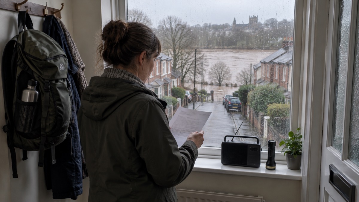
Every day, a small team of forecasters publishes a five-day flood forecast for England and Wales. It is called the Flood Guidance Statement, and each daily statement gives an assessment of the risk of flooding for the next five days1. On most days it says very little is expected: the statement of 19 October 2026, for instance, put the overall flood risk for England and Wales at VERY LOW for the next five days2. On other days it flags trouble ahead, as on 28 January 2026, when significant river flooding impacts were probable in parts of the South of England and the overall flood risk was MEDIUM3.
The statement is written for emergency responders rather than for the public, but it is freely readable, and it tells you something no other forecast does: whether flooding is expected anywhere in England and Wales over the coming five days, from which source, and whether the risk is rising or falling. For a household, it works best as an early heads-up. When it shows an increased risk, that is the moment to check your own property's risk, review your household flood plan and watch for the formal flood alerts and warnings that follow.
What the statement tells you about the next five days
The Flood Guidance Statement is a rolling five-day outlook. Each day's version states the overall flood risk for England and Wales, then breaks that down by the four sources of flooding: river, surface water, coastal and tidal, and groundwater. On 21 July 2026, for example, the river flood risk, the surface water flood risk, the coastal/tidal flood risk and the groundwater flood risk were all VERY LOW for the next five days, and so was the overall risk5. The statement of 12 June 2026 read the same way across every category7.
The numbers alone are only half the picture. The statement also says where impacts are expected, in plain geographical terms. The statement of 28 February 2026 reported ongoing minor river flooding impacts probable on the Somerset Levels and Moors, and significant groundwater flooding impacts probable in Dorset and possible in Wiltshire, with minor impacts probable for parts of Hampshire and West Sussex8. This is the detail a household can act on: if your area is named, the five-day lead time is enough to move valuables, check your flood protection products and make sure you know how to turn off gas, electricity and water.
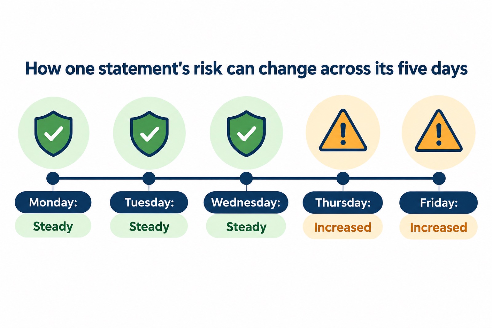
Each statement also carries a "trend since last FGS" line, showing whether the risk for each day is steady, increased or decreased compared with the previous statement. On 7 October 2026 the trend was steady on Wednesday, increased Thursday, increased Friday, steady Saturday, steady Sunday9; on 14 October 2026 it was steady, steady, decreased, steady, steady4. A rising trend early in the five days is your cue to prepare before any formal warning arrives.
Statements are issued at 10:30hrs local time. The 14 October 2026 statement was issued at 10:30hrs on Wednesday 14 October 20264, and the 19 October 2026 statement noted the next was due at 10:30hrs on Tuesday 20 October 20262. When conditions change quickly, the badge on a statement shows that Rapid Flood Guidance products may be issued on the day or days shown9, so a morning statement is not always the last word for that day.
Who the statement is written for, and why households can still use it
The statement is candid about its audience. Each one states: "This guidance is produced to support decision making by Category 1 and 2 emergency responders"4. Those are the emergency services, local authorities and other organisations with duties under the Civil Contingencies Act, and the Met Office has a key role under that Act to provide information to Category 1 and 2 responders as well as to warn and inform the public around severe weather10. In Scotland, the same daily statement goes to Category 1 and 2 agencies such as emergency responders, local authorities, other organisations with flooding management duties and recognised community responders, including the Scottish Flood Forum and the RNLI1.
None of that stops a household reading it. The categories and matrix take a few minutes to learn, the areas at risk are named in plain English, and the five-day view is longer than the formal warning system, which operates only when flooding is expected or happening. Used alongside the services designed for you, it fills the gap between "nothing is happening now" and "a warning has been issued".
The services designed for households are the ones to rely on day to day. Floodline can be used by households and businesses who are at risk of flooding11, and the government's advice is to sign up for flood warnings if your home or business is at risk of flooding12. SEPA is blunt about where responsibility sits: "It is your responsibility to manage your own flood risk and protect yourself, your family, property or business"13. The statement tells you when to look; the warning services tell you whether your street is affected.
The Flood Forecasting Centre: a joint Environment Agency and Met Office service
The statement is produced by the Flood Forecasting Centre, which Derbyshire County Council describes plainly: "This is a joint operation between the Environment Agency and Met Office"14. That pairing is what makes the five-day view possible. Flood risk depends on both the weather coming and the state of rivers, ground and tides, so the Met Office's forecasts and the Environment Agency's hydrological knowledge are combined into a single daily assessment. Local authorities use it the same way: Derbyshire receives severe weather warnings from the Met Office and more detailed extreme rainfall alerts and flood guidance statements from the Flood Forecasting Centre14.
The same partnership model runs across the UK, with different bodies in the lead. In Scotland, the Met Office provides dedicated forecasting services to SEPA's flood warning team15. In Northern Ireland, the Met Office works with the Rivers Agency, the Department for Infrastructure and NI Water to forecast areas where floods are likely16. In England, flood warnings come from the Environment Agency17, and the Met Office points households to the right body for each nation: the Environment Agency for England, NI Direct for Northern Ireland, the Scottish Environment Protection Agency for Scotland and Natural Resources Wales for Wales10.
For professional enquiries, the statement lists a contact for the Flood Forecasting Centre Duty Hydrometeorologist, 0330 135 44006. That number is for responders and organisations; a household wanting warnings for its own home should use the sign-up services described later in this page.
Reading the risk level: from very low to severe
The overall flood risk is read from a matrix that crosses two scales. The likelihood scale runs VERY LOW, LOW, MEDIUM, HIGH3; the impact scale runs MINIMAL, MINOR, SIGNIFICANT, SEVERE3; and the resulting overall risk levels are MINIMAL, VERY LOW, LOW, MEDIUM, HIGH, SEVERE5. In plain terms, the forecasters are judging how likely flooding is and how bad it would be if it happened, then publishing the combination.
| Risk level | What it means on the ground |
|---|---|
| VERY LOW | Isolated and minor flooding of low-lying land and roads; isolated spray or waves on coastal promenades; little or no disruption to travel, but wet road surfaces5 |
| LOW | Localised flooding of land and roads; flooding affecting individual properties5 |
| MEDIUM and above | Disruption to travel and key sites in flood plans; flooding affecting parts of communities; possible danger to life and damage to buildings or structures5 |
| SEVERE | Danger to life, severe disruption to travel; widespread flooding affecting whole communities; widespread disruption or loss of infrastructure; large scale evacuation of properties possible5 |
Two things are worth watching when you read a statement. The first is the difference between "possible" and "probable". The 19 October 2026 statement, while overall VERY LOW, noted that moderate inland flooding impacts were possible but not expected across parts of England and Wales on Thursday and Friday, and moderate coastal flooding impacts were possible but not expected in parts of England on Friday due to large waves and high water levels2. "Possible but not expected" means the risk is real but low; it is a prompt to stay informed, not to act.
The second is the trend line. The 28 January 2026 statement, at MEDIUM overall, showed a steady trend across its five days3; the 19 October 2026 statement showed steady Monday and Tuesday, steady Wednesday, increased Thursday, increased Friday2. An increase mid-week in a statement issued on a Monday gives you several days of notice, which is precisely the value of a five-day forecast.
What minor, significant and severe impacts look like on the ground
The impact scale is the part of the statement that translates most directly into what you would see. A MINOR impact means isolated and minor flooding of low-lying land and roads, isolated spray or waves on coastal promenades, and little or no disruption to travel, but wet road surfaces9. A SIGNIFICANT impact means flooding affecting parts of communities, possible danger to life and damage to buildings or structures, and disruption to travel and key sites in flood plans9. A SEVERE impact means danger to life, severe disruption to travel, widespread flooding affecting whole communities, widespread disruption or loss of infrastructure, and large scale evacuation of properties possible18.
| Impact level | What households could experience |
|---|---|
| MINIMAL to MINOR | Wet roads, isolated flooding of low-lying land and roads, spray on promenades; little or no disruption to travel9 |
| SIGNIFICANT | Flooding affecting parts of communities; possible danger to life and damage to buildings or structures; disruption to travel and key sites in flood plans9 |
| SEVERE | Widespread flooding affecting whole communities; widespread disruption or loss of infrastructure; large scale evacuation of properties possible18 |
The statement also describes the mechanism, not just the level. The 6 October 2026 statement warned that moderate surface water flooding impacts were possible for parts of England that Tuesday and more widely across England on Wednesday, and that impacts could include localised flooding from urban and fast responding smaller watercourses and catchments, drains, channels and flooding from overland flow6. That is the signature of surface water flooding: it arrives quickly with heavy rain rather than building up over days in a river.
For context on what the formal warnings mean when they follow, Nottinghamshire's guidance sets out the impacts behind them: a Flood Warning means flooding of homes and businesses, flooding of roads with major impacts, significant waves and spray on the coast, and extensive flood plain inundation including caravan parks or campsites19. A Severe Flood Warning means deep and fast flowing water, debris in the water causing danger, potential or observed collapse of buildings and structures, communities isolated by flood waters, and a large number of evacuees19. Our page on flood alerts, flood warnings and severe flood warnings explains those in full.
Four sources of flooding the statement covers
The statement assesses each source of flooding separately, because they behave differently and need different responses. Flooding in England comes from rivers, the sea, surface water (rain) and groundwater20.
| Source | What it is | How it behaves |
|---|---|---|
| River | Rivers overflowing their banks | Builds over hours or days; the statement names catchments, as with the Somerset Levels and Moors8 |
| Surface water | Rain that cannot drain away | Fast responding; linked to heavy rain in urban areas, small watercourses, drains and overland flow6 |
| Coastal and tidal | The sea, surges and waves | Driven by tides, storms and large waves; spray on promenades at the minor end5 |
| Groundwater | Water rising through the ground after prolonged rain | Slow to arrive and slow to recede; seen in Dorset, Wiltshire, Hampshire and West Sussex in February 20268 |
The distinction matters to a household because the warning routes differ. For surface water flooding, the best alert system is the Met Office's severe weather alerts system, which lets you know about the heavy rain that causes it21, with Android and Apple apps available to download. River, coastal and groundwater flooding are covered by the Environment Agency's flood warning service, which you can sign up to if your home or organisation in England is at risk17. Our page on the types of flooding goes into each in more detail.
Met Office rain warnings and what to do when one is issued
The Met Office issues local weather warnings based on the level of impacts and the likelihood of them occurring22, using a colour-coded system to show the likelihood and effects of expected severe weather23. When a rain warning covers your area, the Met Office's advice is to follow its three-point plan: check if your property is at risk of flooding, and if at risk prepare a flood plan and an emergency flood kit24. Our checklist for when a flood warning is issued and our guide to making a household flood plan walk through those steps.
- Check whether your property is in a flood risk area, and sign up for flood warnings by text, phone or email25.
- Prepare a flood plan and an emergency flood kit; the fire and rescue service advice includes warm, waterproof clothes and blankets in that kit26.
- Check the weather forecast regularly; the Met Office provides forecasts for locations around the country23.
- If flooding is forecast, be aware of flood risk by signing up for flood warnings at Check for Flooding on GOV.UK22.
- If a warning escalates, turn off your gas, electricity and water supplies if it is safe to do so27.
If you have to drive while a rain warning is in force, the fire and rescue service advises using dipped headlights in heavy rain and flooding26. If the situation becomes serious, the Met Office's seasonal advice is clear about what not to do: do not go into attic spaces to avoid being trapped by rising water, and if you are trapped by floodwater or affected by fast flowing or deep water, call 999 and wait for help24. If you are worried about your health or that of somebody you know, ring NHS 11124. If the emergency services tell you to evacuate, leave the area27. For what warnings mean for storms more broadly, see our guide to storms, snow and ice.
There is a longer-term reason to keep this habit. According to the Met Office, the UK is likely to have hotter, drier summers and warmer, wetter winters, and the Met Office has charted higher annual temperatures, increased days with very heavy rainfall and record-breaking high temperatures since the 1961 to 1990 period28. Extreme weather events such as heatwaves and heavy downpours are likely to become more frequent and more intense28. Checking the forecast and the statement regularly is a small routine that earns its keep as the weather becomes less predictable.
Never walk, drive or swim through floodwater
Every official source in this field gives the same instruction, and it deserves its own heading. The government's flood help page says do not walk, cycle or drive through flood water27. West Midlands Ambulance Service puts it more broadly: "It is not safe to drive, walk or swim through floodwater."25 London's guidance is equally direct: "Never drive through flood water."21
The reasons are practical, not fussiness. Floodwater can be deep and fast flowing, can carry debris that causes danger, and can hide open manholes and damaged road surfaces19. A Severe Flood Warning means there is a danger to life20. If you want the full picture, our page on whether it is safe to walk or drive through floodwater covers depth, current and what lies beneath the surface.
Where to check the latest flood risk and warnings
The statement is the five-day view; for what is happening now, use the live services. In England, get flood warnings from the Environment Agency if your home or organisation is at risk, by text, phone or email17. In Scotland, SEPA's live flooding information is available at floodline.sepa.org.uk/floodupdates for the latest local weather and flood updates29, and you can register for free advance notice of flooding direct to your phone by calling Floodline on 0345 988 11881. In Northern Ireland, the flooding incident line is 0300 200 010016.
| Nation | Live flood information | Warnings for your property |
|---|---|---|
| England | Check for Flooding on GOV.UK22 | Environment Agency warnings by text, phone or email17 |
| Scotland | SEPA live flooding at floodline.sepa.org.uk/floodupdates29 | Floodline, 0345 988 11881 |
| Wales | Natural Resources Wales10 | See our Wales warnings and risk maps page |
| Northern Ireland | NI Direct10 | Flooding incident line, 0300 200 010016 |
For weather warnings, the Met Office says you can sign up to its email alerts or download its Weather App to ensure you are always updated with the very latest forecast details10. Surrey's resilience guidance also lists the Met Office on social media at @metoffice30. Know who to contact if flooding happens in your area13; our page on who to report flooding to covers that.
Finally, check your own property's risk rather than relying on the national picture. Check your flood risk and sign up to flood alerts at www.gov.uk/check-flood-risk30, and view the flood maps for your area31. Our guide to checking your home's flood risk by postcode explains how to read them, and if you are not yet signed up, our page on how to sign up for free flood warnings takes you through it step by step.
Sources (31)
- Scottish Flood Forecast FAQs, SEPA, 2026-10-29
- Flood Guidance Statement, 19 October 2026, Flood Forecasting Centre, 2026-10-19
- Flood Guidance Statement, 28 January 2026, Flood Forecasting Centre, 2026-01-28
- Flood Guidance Statement, 14 October 2026, Flood Forecasting Centre, 2026-10-14
- Flood Guidance Statement, 21 July 2026, Flood Forecasting Centre, 2026-07-21
- Flood Guidance Statement, 6 October 2026, Flood Forecasting Centre, 2026-10-06
- Flood Guidance Statement, 12 June 2026, Flood Forecasting Centre, 2026-06-12
- Flood Guidance Statement, 28 February 2026, Flood Forecasting Centre, 2026-02-28
- Flood Guidance Statement, 7 October 2026, Flood Forecasting Centre, 2026-10-07
- Community resilience, Met Office, 2026-10-25
- Preparing for a flood, Nottinghamshire County Council, 2026-10-29
- Get prepared for emergencies: alerts, Prepare Campaign, 2026-10-20
- Responsibilities for flooding, SEPA, 2026-10-29
- Flood warnings and emergency preparedness, Derbyshire County Council, 2026-10-29
- Flooding information and advice, The Highland Council, 2025-09-25
- Staying warm in winter, nidirect, 2026-10-06
- Get flood warnings by text, phone or email, GOV.UK, 2026-10-29
- Flood Guidance Statement, 26 June 2026, Flood Forecasting Centre, 2026-06-26
- Flood warnings explained, Nottinghamshire County Council, 2010-11
- Flooding: be informed about hazards, Prepare Campaign, 2026-10-12
- Severe weather and flooding advice, Greater London Authority, 2026-10-26
- Storms and gales: protect yourself, Lancashire Prepared, 2026-10-29
- Met Office weather warnings explained, Essex Prepared, 2026-10-29
- Stay safe in heavy rain, Met Office, 2026-10-28
- Staying safe in flooding, West Midlands Ambulance Service NHS Foundation Trust, 2026-05-20
- Keeping safe during high winds and heavy rain, North Yorkshire Fire and Rescue Service, 2024-01-22
- Help during a flood, GOV.UK, 2026-10-25
- Adapting to extreme weather, Derbyshire County Council, 2026-10-29
- Resilience and emergency preparedness, West of Scotland Innovation Hub, 2026-10-28
- Surrey Prepared resilience guidance, Surrey County Council, 2026-10-29
- Developing our knowledge: flooding, SEPA, 2026-10-29
 Flood Warning Checklist
 First Steps After a Flood
 Insurance Claim Records
 Checking Flood Risk by Postcode
 Types of Flooding
 Flood Alerts and Flood Warnings
 Wales Flood Warnings and Maps
 Making a Household Flood Plan
 Protecting Your Home
 Door Flood Barriers
 Sandbags and Alternatives
 Flood Doors and Windows
 Airbrick Covers
 Non-Return Valves and Bungs
 Sump and Submersible Pumps