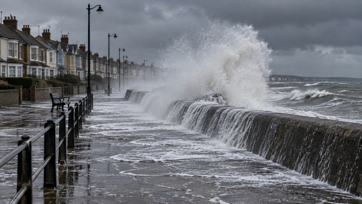
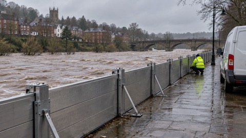
Coastal flooding happens when high tides and stormy weather combine. The sea level rises, waves grow, and seawater overtops sea defences and encroaches onto the land1. When the storm is severe enough, a tidal surge forms: a body of raised seawater driven towards the coast by low pressure and strong winds, arriving on top of an already high tide2. The result can be serious flooding of homes, farmland and roads, sometimes with little warning for people caught on the shoreline.
The greatest threat is on the east coast of England, from Northumbria to Kent, where a combination of low pressure over the North Sea, high spring tides and northerly gales can drive a surge down the coast towards the English Channel3. The Environment Agency's 2024 national assessment found 2.4 million properties in England in areas at risk of flooding from rivers and the sea, and 3,500 properties in areas at risk of coastal erosion in the period up to 20554. Coastal flooding is rated one of the most significant risks on the UK's National Risk Assessment3.
This page explains how tides and surges combine, what to do when waves are high, how warnings work in each nation, how to check your erosion risk, and what the 1953 North Sea flood, the worst coastal flood in modern UK history, taught the country about the value of acting on warnings.
How a tidal surge and a high tide combine
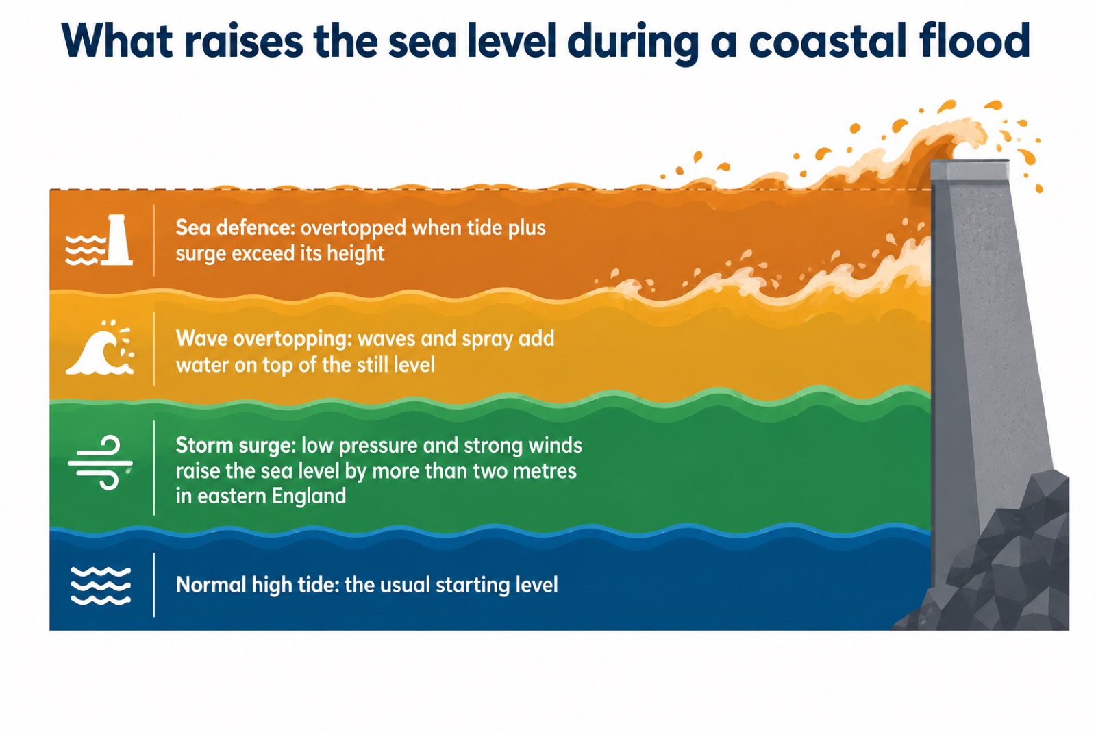
Coastal flooding is predominantly caused by high tides and stormy weather combining, leading to the overtopping of sea defences with seawater then encroaching onto the land1. Two things have to go wrong at once. First, the tide must be high: the highest tides, the spring tides, come roughly twice a month when the sun and moon align, and any flooding that arrives on top of them starts from a higher base. Second, the weather must be stormy: low atmospheric pressure over the sea lets the sea surface lift, and strong winds then pile that raised water against the shore.
When strong winds combine with very low pressure, they can raise the sea level in eastern England by more than two metres7. That raised water is the surge. If it arrives as the tide is peaking, the total sea level can exceed the height of sea defences, and the water comes over the top rather than through a breach. Strong onshore winds add large waves and spray on top of the still water level, and in some places official risk maps take account of potential flooding from wave overtopping as well as the still sea level itself8.
Coastal flooding also reaches inland, beyond the open shoreline. Tidal flooding affects coastal areas, estuaries and tidal stretches of river9, so a property several miles from the beach can still flood if it sits on a tidal river whose level is pushed up by a surge meeting a high tide. Flooding along coastlines can also be made worse when a storm surge coincides with higher than normal river levels or with surface water from the same storm's rain10. The worst coastal floods are the ones where the surge, the tide, the river and the rain all arrive together.
Stay away from the coast when there are high waves
The single most important safety rule during any coastal storm is simple: always stay away from the coast when there are high waves. It is very dangerous for people to be on the coastline when there are high waves5. Large waves and sea spray can be dangerous on beaches, promenades, coastal footpaths and roads11. People are most often hurt not by flooding itself but by being swept from a sea wall, a harbour arm or a slipway while watching the waves.
"Always stay away from the coast when there are high waves. It is very dangerous for people to be on the coastline when there are high waves."
The danger is greatest around high tide, when waves reach furthest up the shore. During Storm Amy in October 2025, the Met Office reported that a combination of large waves and high winds would bring danger to life on exposed coastlines, particularly around high tides, and urged the public to stay away from the coast, and if in doubt to stay away from exposed coastal areas12. That is the standard advice in every storm: if you do not need to be at the coast, do not go.
If flooding reaches your property, move to higher ground or upper floors if it is safe to do so, and stay away from shorelines13. Avoid contact with flood water, as it may be contaminated with sewage and other pollutants14. Do not walk on sea defences, riverbanks or bridges during a flood14. If the emergency services tell you to evacuate, leave the area15. For the full sequence of steps once water is threatening your home, see what to do during a flood.
Keep up to date with storm and gale warnings
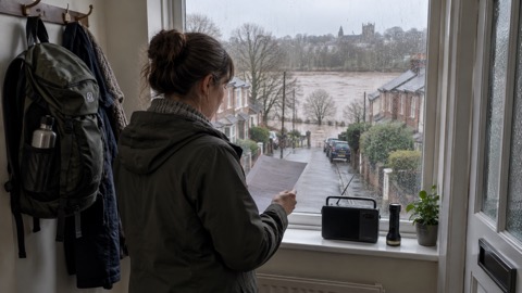
Coastal flooding is almost always forecastable, which means the actions that protect you start days before the water arrives. Stay informed: look at the weather forecast and check the Met Office for weather warnings and details of risk in your area11. You can keep up to date with weather warnings by checking the latest forecast on your TV or radio17, and you can sign up to Met Office weather warnings so that alerts reach you directly rather than depending on you remembering to look [25, see also S25 in sources list]. In Northern Ireland, you can get flood updates in local news, weather and traffic bulletins18.
Alongside the weather warnings, check the flood warnings for your area. In England, the Flood Guidance Statement, published daily by the Flood Forecasting Centre, rates coastal and tidal flood risk for England and Wales for the next five days on a scale from very low to high19. A very low rating means isolated and minor flooding of low-lying land and roads, isolated spray or wave on coastal promenades, and little or no disruption to travel19. When the rating rises, so should your preparations. Our page on the Flood Guidance Statement and five-day forecasts explains the scale in full.
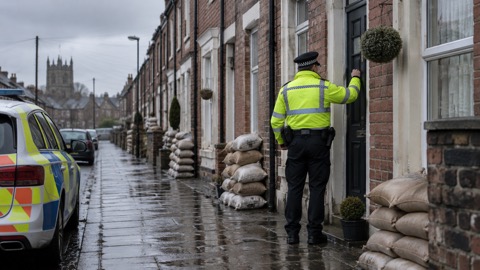
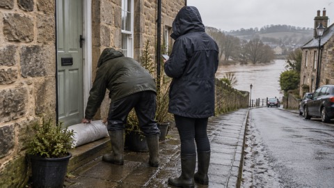
The warning levels themselves are consistent across the kinds of flooding. A flood alert means flooding is possible, be prepared; a flood warning means flooding is expected, take action6. A flood alert provides an early indication of potential flooding from coasts, rivers or surface water, while a flood warning is issued when flooding is expected for a defined local area20. Sign up for the free warning service for your property, and check that neighbours know about any flood warnings that have been issued, especially if they are elderly, sick or disabled21. See how to sign up for free flood warnings and flood alerts, warnings and severe flood warnings.
| Warning | What it means | What to do |
|---|---|---|
| Flood alert | Flooding is possible6 | Be prepared; check your flood plan |
| Flood warning | Flooding is expected for a defined local area20 | Take action: put up barriers, move things upstairs, turn off supplies if safe15 |
| Severe flood warning | Danger to life | Follow evacuation instructions from the emergency services15 |
What storms and gales can do to homes, power and roads
A coastal storm is not only a flood risk. Storms and gales can cause significant damage to buildings and infrastructure and result in fallen trees, coastal flooding, power cuts and disruption to the transport network11. Gale force winds or storms may cause loss of power, disruption to the transport network and damage to homes and businesses5. Deaths and injuries from falling trees, and road accidents, are among the recorded consequences of severe storms5.
The damage takes several forms, and a household should be ready for more than one at a time:
- Structural damage: falling trees, and damage to buildings such as a roof being ripped off by the wind5
- Power and communications failure: utility and telephony failure, meaning phones and internet may not work either9
- Travel disruption: risk to high-sided vehicles and other traffic, vehicle collisions, and roads blocked by water or debris9
- Coastal flooding and erosion: storm surges and high tides that can lead to coastal erosion as well as flooding22
- Roads under water: around a third, 38%, of all roads in England are in areas at risk from one or more sources of flooding, rising to 46% by mid-century4
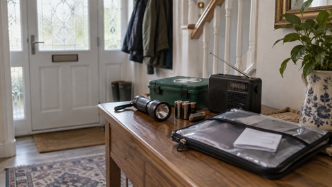
Because power cuts and transport disruption often accompany coastal flooding, prepare for them together. Keep torches where you can find them in the dark, a battery or wind-up radio for warnings and news, and a way to charge phones when the mains is down. Our guides on power cuts, emergency lighting and staying informed in an emergency cover the kit and habits that carry a household through a storm. If a storm is named and heading for your coast, expect the electricity and the roads to be affected even if your home never takes in water.
The east coast from Northumbria to Kent faces the greatest threat
Not all coasts face the same risk. The east coast of England, from Northumbria to Kent, is under the greatest threat from coastal flooding, because a combination of low atmospheric pressure over the North Sea, high spring tides and northerly gales can drive a storm surge down that coast towards the English Channel3. The North Sea funnels: a deep depression moving south over the sea, with northerly gales behind it, pushes water ahead of it into a narrowing basin, and the surge grows as it travels.
The national statistics bear this out. The East Midlands, Yorkshire and the Humber, and South East regions account for about half, 52%, of all properties in England in areas at high or medium flood risk from rivers and the sea; fewer than 1 in 10 of those properties are in London, largely due to major flood defences such as the Thames Barrier4. Within coastal erosion, places such as East Riding of Yorkshire, North Norfolk and Cornwall have some of the highest numbers of properties in areas at erosion risk4. In Essex, the coastline including Southend-on-Sea and the Tendring Peninsula is susceptible to coastal flooding, especially during storms that coincide with high tides23.
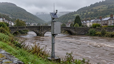
Wales has its own concentration of risk. Natural Resources Wales shows combined risk from extreme sea levels and wave overtopping for the Caldicot and Wentlooge Levels in south east Wales, Point of Ayr to Pensarn on the north Wales coast, and between Borth and Abersoch in west Wales16. In Scotland, communities such as Buckie and Portessie face mainly coastal and surface water flooding, and Pennan's main source of flooding is coastal flooding [18, see S59 in sources list]. Wherever you are, the way to find out is to check your own address: see checking your home's flood risk by postcode and, for Wales, Natural Resources Wales warnings and risk maps.
How many homes are at risk
The numbers give a sense of scale, and they have been counted carefully. The Environment Agency's 2024 National Flood Risk Assessment for England found 2.4 million properties in areas at risk of flooding from rivers and the sea, slightly fewer than the previous assessment's 2.6 million as of December 20234. In total, around 6.3 million properties in England are at risk of flooding from one or more sources, and about 750,000 are at risk both from rivers or the sea and from surface water4.
Of the properties at risk from rivers and the sea, 163,300 are likely to flood to depths of 30cm or higher, which is over two fifths, 44%, of all properties in high-risk areas4. With climate change, that figure is projected to reach 288,800 between 2036 and 2069, a 77% increase from the present day, and the number of properties at risk from rivers and the sea is projected to rise to 3.1 million over the same period4.
Erosion is a smaller but harder problem, because the sea takes land permanently. The new National Coastal Erosion Risk Map shows 3,500 properties in England in areas at risk of coastal erosion in the period up to 2055, rising to about 10,100 properties in the period up to 2105, with about half residential and half non-residential4. Even with shoreline management plans delivered, there could be 19,700 properties in areas at risk of erosion by the end of the century; without that investment, the figure is expected to be five times greater, and the total in areas at erosion risk up to 2055 could reach up to 32,800, nine times greater4. The Environment Agency's flood and coastal risk management report for 2024 to 2025 confirms the headline figure: 3,500 properties are at risk of coastal erosion by 205524.
| Risk | Properties | Period | Source basis |
|---|---|---|---|
| Flooding from rivers and the sea, England | 2.4 million | present day, 2024 assessment4 | national flood risk assessment |
| Flooding from any source, England | around 6.3 million | present day4 | national flood risk assessment |
| Coastal erosion, England | 3,500 | up to 20554 | NCERM, assuming defences maintained |
| Coastal erosion, England | about 10,100 | up to 21054 | NCERM, assuming defences maintained |
| Coastal erosion, England, no investment | up to 32,800 | up to 20554 | worst case scenario |
| Coastal flooding, Wales | over 80,200 residential and 9,400 non-residential | 2026 [18, see S47 in sources list] | Welsh risk assessment |
In Wales, over 80,200 residential properties are at risk of coastal flooding, along with 9,400 non-residential properties and almost 2,000 key services [18, see S47 in sources list]. In Scotland, 1 in 22 homes and 1 in 13 non-residential properties are at risk of flooding from all sources14.
Coastal erosion and the National Coastal Erosion Risk Map
Erosion differs from flooding in one fundamental way: floodwater recedes, but eroded land is gone. Coastal erosion is the wearing away of the shoreline by the sea, and the National Coastal Erosion Risk Map, usually called NCERM and first published in 2011, is the official map of where it is expected in England4. The last update to NCERM was in 2017, and the 2024 national assessment refreshed the picture of how many properties the map places at risk4.
If you live on, own or are buying a coastal property, check it on NCERM. The map shows areas at risk of erosion over set time periods, which matters both for how you use the land and for what happens when you sell or insure it. Alongside the map, make sure your insurance provides cover against flood damage to property18. Erosion risk and flood risk are related but not identical: a property can sit safely above the reach of any flood but still stand on ground the sea will eventually take, and the reverse is also true.
The projections depend heavily on what is spent on defences. The figures above assume that shoreline management plans, the plans that set how each stretch of coast is managed, are funded and carried out. Without that investment, the number of properties in areas at erosion risk up to 2055 would be nine times greater, reaching up to 32,800, and by the end of the century with climate change the worst case reaches 102,100 properties4. For a household, the practical reading is that erosion risk at a given address can change as policy and funding change, so re-check the map periodically rather than relying on an old search. For ways to reduce flood damage to a home that is at risk, see protecting your home.
The 1953 North Sea flood: the benchmark storm
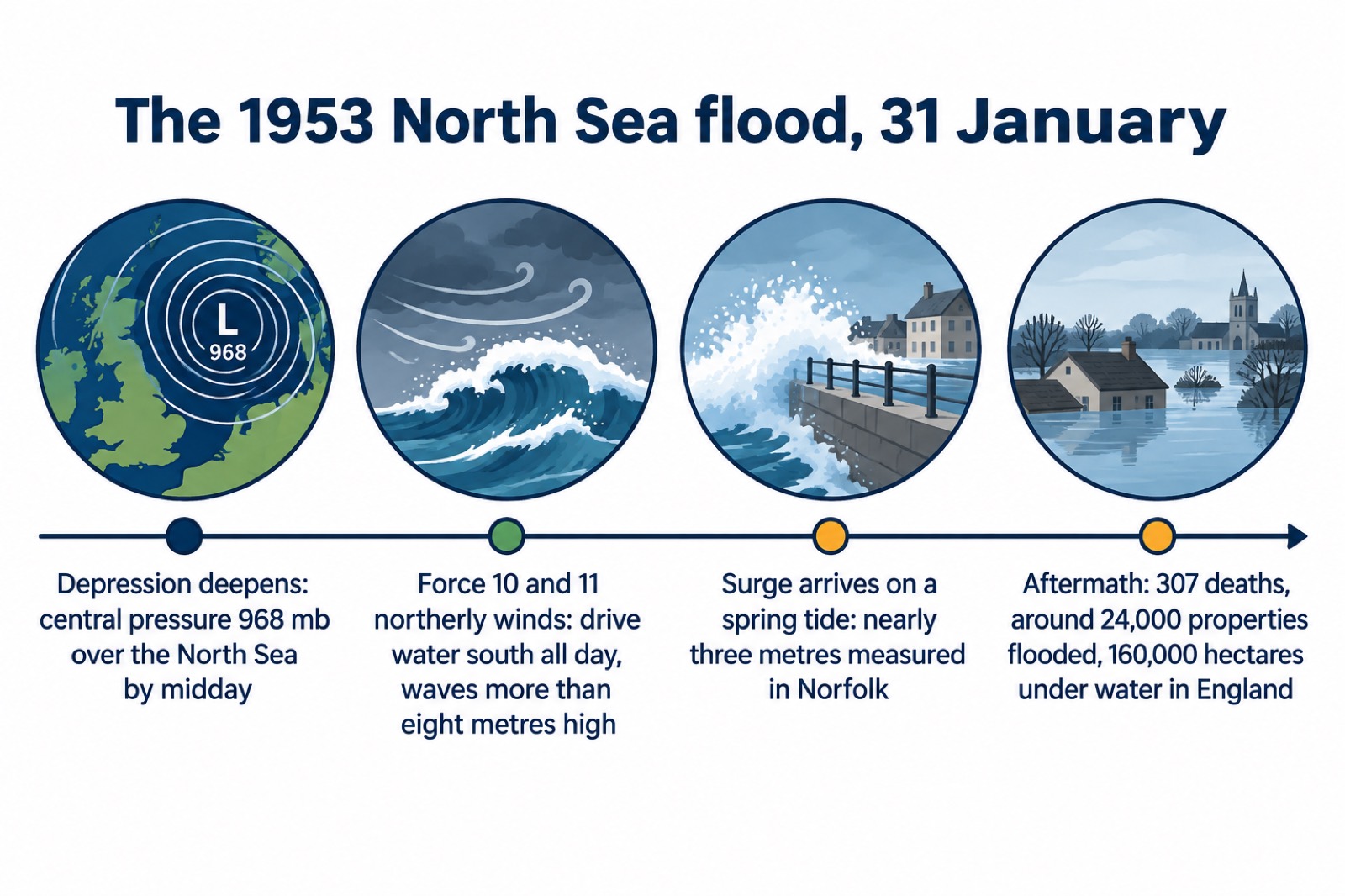
Every coastal flood plan in the UK is measured against one event. More than 2,000 people drowned at the end of January 1953 when the greatest surge on record happened in the North Sea7. In eastern England, 307 people died, about 160,000 hectares were flooded, and around 24,000 properties were flooded7. In the Netherlands, a further 200,000 hectares were flooded and 1,800 people drowned7.
The storm built in a way that is still the textbook case. A depression moved over the North Sea and deepened to 966 mb before filling; by midday on 31 January it was centred over the North Sea between Aberdeenshire and southern Norway, with a central pressure of 968 mb7. All that day, Force 10 and 11 winds blew from the north over western parts of the North Sea, driving water south and generating waves more than eight metres high7. The surge measured nearly three metres in Norfolk, and even more in the Netherlands7. It arrived on top of a high spring tide, which is precisely the combination described at the top of this page.
Why warnings matter: the lesson of 1953
The deadliest failure of 1953 was not the defences; it was the warnings. Because many telephone lines in Lincolnshire and Norfolk were brought down by the wind, virtually no warnings of the storm's severity were passed to counties farther south until it was too late7. Communities farther down the east coast had no way of knowing what was coming towards them until the water arrived. That single failure is a large part of why coastal flooding is now rated one of the most significant risks on the National Risk Assessment3, and why the UK built a warning and forecasting system that reaches households directly.
Today the system works at two levels. Nationally, the Flood Forecasting Centre issues a daily Flood Guidance Statement rating coastal and tidal flood risk for England and Wales for the next five days19. Locally, flood alerts and flood warnings are issued for defined areas: a flood alert means flooding is possible and provides an early indication of potential flooding from coasts, rivers or surface water; a flood warning means flooding is expected for a defined local area20. In Scotland, SEPA operates the same structure, with flood alerts issued for all sources of flooding including coastal, and flood warnings covering smaller, community-level areas; there are 326 fluvial and coastal flood warning areas across Scotland6. Scotland's Flood Forecast shows live flood information over the next three days25.
The comparison with 1953 is the measure of success. The Met Office's own account of the flood notes the improvement in national capability when compared with the 307 deaths and around 24,000 properties flooded in 19537. But a warning only protects the household that receives it and acts on it. Sign up for warnings for your address, make a flood plan so everyone knows what to do if flooding is predicted14, and when a warning arrives, act: turn off your gas, electricity and water supplies if it is safe to do so, and do not touch an electrical switch if you are standing in water15. Our checklist when a flood warning is issued sets out the steps in order.
Rising sea levels may make coastal flooding more frequent
The risk is not standing still. Rising temperatures and sea levels, and an increase in the frequency and severity of extreme weather events, are likely to raise the risk of flooding in the UK3. In Essex, rising sea levels and an increase in extreme weather events are expected to exacerbate flooding risks23. Flood risk can change over time, increasing with heavier or longer rain, more impenetrable surfaces like tarmac, fewer trees and vegetation, and climate change16.
The national assessments put numbers on the direction of travel. SEPA's National Flood Risk Assessment 2025, published in December 2025, found that coastal flooding will see the largest proportional rise in risk as sea levels rise and storm surges intensify, with risk from the sea for coastal communities projected to more than double by 210026. River flooding will also surge, with homes in high-risk zones expected to double by the end of the century26. In England, the 2024 assessment projects 3.1 million properties in areas at risk of flooding from rivers and the sea between 2036 and 2069, up from 2.4 million today4. The England assessment uses a higher central climate allowance for sea flooding and coastal erosion than for river and surface water flooding, reflecting the greater confidence in rising sea levels4.
For a household, this changes what "at risk" means over the years you own a home. A property just outside the flood map today may move inside it as the century progresses, and defences that hold now may need raising or may not be maintained. The practical responses are the same at any level of risk: know your risk, keep your insurance cover under review, sign up for warnings, and keep a flood plan current. Flooding in Scotland is already happening more often with changes to the weather, and SEPA's advice is that it is likely that you or someone you know will be affected25.
Getting help and more information
Each nation runs its own warning service, and the help available follows the same pattern. In England, sign up for Environment Agency flood warnings and call Floodline; in Scotland, SEPA issues flood alerts and warnings and runs Floodline; in Wales, Natural Resources Wales does the same. Our page on Floodline numbers for England, Scotland and Wales lists them. If you need extra help during an emergency, for example because of age, disability or medical dependence, see extra help in an emergency.
Related guides on this site that carry the story forward:
- Checking your home's flood risk by postcode
- Types of flooding: river, sea, surface water and groundwater
- Flood alerts, flood warnings and severe flood warnings
- What to do during a flood at home
- After a flood: returning home safely
- Storms, snow and ice: a household guide
Sources (26)
- Flooding risks, Wiltshire and Swindon Prepared, 2026
- Be Flood Ready guidance for flood wardens, Harborough District Council
- Protecting your family: flooding, Essex Prepared
- National assessment of flood and coastal erosion risk in England 2024, Environment Agency, 2026
- Storms, gales and high waves, Dorset Prepared, 2024
- About flood alerts and warnings, Scottish Environment Protection Agency
- Weather case studies: floods, Met Office
- Different types of flood risk maps, Natural Resources Wales
- Severe weather and emergency planning, Pembrokeshire County Council
- Flooding FAQs, Scottish Environment Protection Agency
- Storms and gales, Lancashire Prepared
- Amber and yellow warnings in force for Storm Amy, Met Office, 2025
- Flooding: Ready Scotland, Ready Scotland, 2026
- Flooding guide for communities, Scottish Environment Protection Agency
- Help during a flood, GOV.UK
- Understanding your flood risk results, Natural Resources Wales
- Storms and wind: Ready Scotland, Ready Scotland, 2026
- Preparing for a flood, nidirect, 2025
- Flood Guidance Statement, 10 September 2026, Flood Forecasting Centre, 2026
- Floodline service leaflet, Scottish Environment Protection Agency, 2018
- Flooding advice, Mid and West Wales Fire and Rescue Service
- Severe weather: ongoing risks, Essex Prepared
- Flooding: ongoing risks, Essex Prepared
- Flood and coastal erosion risk management report, 1 April 2024 to 31 March 2025, Environment Agency, 2025
- Prepare for flooding, Scottish Environment Protection Agency
- National Flood Risk Assessment, Scottish Environment Protection Agency, 2025
 Flood Warning Checklist
 First Steps After a Flood
 Insurance Claim Records
 Checking Flood Risk by Postcode
 Types of Flooding
 Flood Alerts and Flood Warnings
 Flood Guidance Statement
 Wales Flood Warnings and Maps
 Making a Household Flood Plan
 Protecting Your Home
 Door Flood Barriers
 Sandbags and Alternatives
 Flood Doors and Windows
 Airbrick Covers
 Non-Return Valves and Bungs