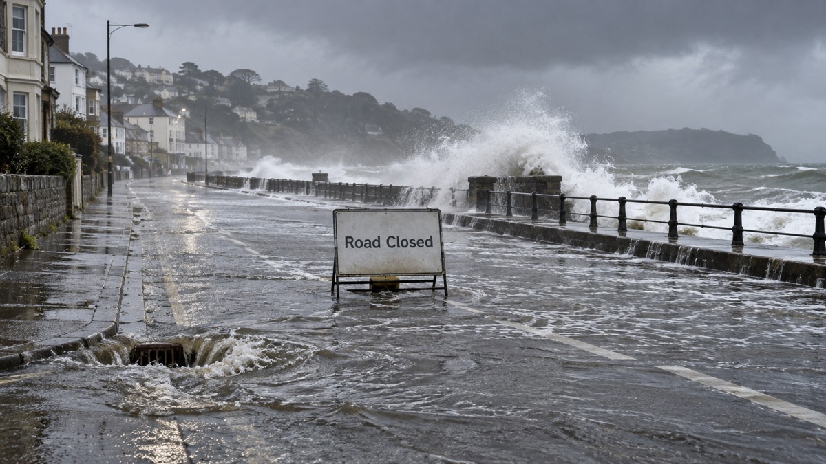
Storm Bram affected the UK on 9 and 10 December 2025, bringing widespread transport disruption, power outages and some flooding1. The Met Office said it was the fourth named storm to affect the UK during the 2025/2026 season, and that it was named by the Western European storm naming group, which includes the UK1. Natural Resources Wales dates the storm's effects across Wales to 8 to 10 December 20252.
The Met Office recorded winds gusting at over 60Kt (69mph) in the worst affected locations, with up to 100mm of rain in the wettest areas falling on saturated ground1. The strongest winds were in the Western Isles, around Irish Sea coasts, southern Scotland, Northern England and North Wales1. The highest gusts were 73Kt (84mph) at Capel Curig, Conwy and 71Kt (82mph) at Aberdaron, Gwynedd, while 66Kt (76mph) was recorded at ten stations including North Wyke in Devon, Killowen in County Down, Ronaldsway on the Isle of Man, Mona on Anglesey and Salsburgh in Lanarkshire1. Several stations recorded their highest December gust speed since 2013, and at North Wyke the 66Kt gust was the highest December gust speed in a 25-year record1. Rainfall totals on 8 December included 104.7mm at White Barrow, 86.2mm at Princetown Prison and 85.1mm at Holne, Priddons Farm, all on Dartmoor in Devon, and totals in South Wales locally exceeded 60mm1.
Several thousand properties in England, Wales and Northern Ireland experienced power cuts1. Many rail services were cancelled or faced speed restrictions, including Great Western Railway and Scotrail, and in Wales a train was reported to have hit a tree on a line between Blaenau Ffestiniog and Llandudno1. A section of the M74 was closed with several HGVs overturned, and the M48 Severn Bridge was closed due to high winds1. Several ferry routes on the west coast of Scotland and across the Irish Sea were cancelled or disrupted, and dozens of flights between the island of Ireland and Great Britain were also cancelled1.
Numerous widespread flood warnings were issued, and a number of properties flooded in Totnes, Devon from the River Dart1. In Plymouth, a section of the West Hoe Pier collapsed due to large waves, and in Carrickfergus, near Belfast, part of a sea wall was washed away1. Natural Resources Wales reported that properties were flooded in the Briton Ferry area of Neath Port Talbot from surface water, with multiple roads and train lines facing disruption from flooding, and reports of isolated property flooding in the Monnow catchment2.
"Storm Bram brought widespread transport disruption, power outages and some flooding."
The Met Office described the storm as "a notable but not exceptional Atlantic winter storm"1. It drew in exceptionally mild Tropical Maritime air: daily maximum temperatures on 9 December reached 16.8°C at Carlisle, against a 1991-2020 December average of 7.4°C at that station, and Hurn in Dorset recorded a daily minimum of 11.7°C against a December average of 2.0°C1. Rainfall totals from the event were not exceptional, but there were concerns over flooding because of the prolonged unsettled weather during November and early December, which left ground saturated and rivers running high1. Parts of the Welsh hills and Cumbrian fells recorded over 600mm of rain between 1 November and 10 December 2025, including 783.0mm at Treherbert, Mid Glamorgan and 1081.8mm at Honister Pass, Cumbria1.
Why it matters for households
The Met Office's account sets out the practical effects households faced during the storm: loss of electricity for several thousand properties across England, Wales and Northern Ireland, cancelled rail and ferry services, closed motorway sections and bridge closures, and flooding of properties in Totnes1. Natural Resources Wales reports further property flooding in the Briton Ferry area and disruption to roads and train lines in Wales2. The Met Office attributes the flooding risk to saturated ground and high rivers following a prolonged unsettled spell, rather than to exceptional rainfall during the storm itself1. Natural Resources Wales records that Wales had its tenth wettest autumn since records began in 1836, with 37% above average rainfall, and that from April 2025 to March 2026 there were 140 days of elevated flood risk and, within those, 33 days of heightened flood risk2. It estimates that 275,000 properties in Wales are at risk of flooding, approximately 1 in 72.
What happens next
The Met Office published its account of Storm Bram on 12 December 20251. Natural Resources Wales reports that its new Flood Warning Information Services for Wales went live on 17 July 2024, that it developed and made operational three new river flood forecasting models for the Upper Wye, Lower Wye and Cadoxton, and that its £6m Telemetry system, Tanio, will go live in early 2026/272. It also reports that updated climate allowances were published on 20 March 2026, including allowances for peak river flows and extreme rainfall events based on UKCP18 outputs2.
Households can read more on storms and snow, power cuts and flooding, including how long until the electricity comes back, what happens to the electricity network in storms, flood alerts, flood warnings and severe flood warnings, Natural Resources Wales warnings and risk maps for Wales, coastal flooding and tidal surges, the Flood Guidance Statement and five-day forecasts, getting warnings without email, flood doors and windows, home insurance in a flood risk area and Flood Re, whether to delay a journey in bad weather and trains, buses and bridge closures in bad weather.
Sources (2)
- metoffice.gov.uk, metoffice.gov.uk
- Natural Resources Wales / Flood risk management annual report 2025 to 2026, naturalresourceswales.gov.uk
 Delaying Journeys in Bad Weather
 Travel Disruption in Bad Weather
 How Long Until Power Returns
 Storms and the Electricity Grid





