Natural Resources Wales (NRW) has reported that November 2024 was the month with the most visits to its website, with nearly 400,000 total visits resulting from Storm Bert1. The figure appears in the agency's flood risk management annual report for 2024 to 2025, covering the financial year from April 2024 to March 20251.
Storm Bert brought very wet and windy weather to Wales over the weekend of 23 to 24 November 2024. There were widespread rainfall totals of 50 to 100mm across Wales, with over 150mm in the wettest upland areas, and in many places in South Wales the rainfall over the three days from 22 to 24 November was 70% or above of the November average. 23 November was the wettest day in the UK since October 2020 and the 12th wettest in the UK series from 1891. Some rivers in South Wales reached their highest ever recorded levels1.
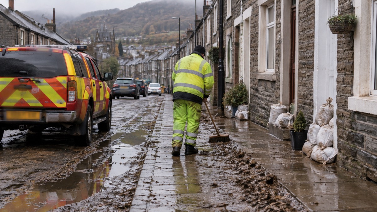
During Storm Bert more than 700 homes across Wales experienced flooding, with Pontypridd, which was badly affected during Storm Dennis in 2020, again one of the most severely affected communities. A landslip at Cwmtillery in Blaenau Gwent, where a disused coal tip partially collapsed, forced the evacuation of around 40 homes, and a large sinkhole opened on a residential street in Merthyr Tydfil after an underground culvert was damaged by boulders. Flooding and infrastructure damage closed the Heart of Wales and Marches railway lines and roads including the A479 in Powys and the A4042 in Monmouthshire1.
The report also records that Storm Darragh, on 6 to 7 December 2024, brought very strong winds to West Wales and the South Wales coastline, prompting a rare red weather warning from the Met Office and a UK Government emergency alert by phone, the first use of that system since it was introduced in 2023. The destructive winds significantly damaged power infrastructure, with more than 259,000 homes without power at the peak of electricity network disruption1.
"November was the month with the most visits to our website with nearly 400,000 total visits resulting from Storm Bert."
On warning systems, NRW reports that its new Flood Warning Information Services for Wales went live on 17 July 2024, delivered through a £5m multi-year project that replaced the previous flood warning system and decoupled Wales from the previous England and Wales service1. The report says a project to replace the ageing Telemetry system was advanced and is due for roll out later in 20251.
| Measure | Figure |
|---|---|
| Website visits in November 2024 | Nearly 400,0001 |
| Homes flooded in Wales during Storm Bert | More than 7001 |
| Homes without power at peak of Storm Darragh disruption | More than 259,0001 |
| Properties at risk of flooding in Wales (estimated) | 275,000, about 1 in 71 |
| Welsh Government funding for flood risk management activities, 2024/25 | £47m1 |
Why it matters for households
The report states that in Wales there are estimated to be 275,000 properties at risk of flooding, approximately 1 in 7 properties. As of April 2025, the undefended sum of properties at risk of flooding in Wales is 342,436, and removing double or triple counting of properties at risk from multiple sources there are over 274,000 properties at risk1. It projects that by 2120 there will be over 131,000 properties at risk from the sea and nearly 131,000 at risk from rivers, increases of nearly 40,000 and over 24,000 respectively from present day, with over 48,000 more properties at risk from surface water and small streams2.
For households in flood warning areas, the practical position set out in the report is that warnings depend on a chain running from rain gauges and river gauging stations through forecasting models and ICT systems to the public, and that warnings need to be understood and acted on1. NRW's own account of Storm Bert describes staff tracking forecasts, issuing warnings, checking flood assets, posting information on its website and social media, and supporting local authorities, emergency services and utility companies1. The report does not give a breakdown of how many warnings were issued for Storm Bert, and this has not been reported.
The report also records that NRW maintains over 3,900 flood risk management assets, including approximately 455km of raised defences, and that 97.23% of its flood assets in high flood risk systems were found to be at or above their required condition, just short of a 98% target3. It notes the completion of the Stephenson Street flood alleviation scheme in Newport, reducing flood risk to 1,032 properties, and a scheme at Sandycroft, Flintshire (218 properties)1.
What happens next
The Welsh Government published a revised planning policy, TAN15: Development, Flooding and Coastal Erosion, on 31st March 20251. NRW released an updated Communities at Risk Register in January 2025, alongside a Climate Change Communities at Risk Register for the first time1. The report says the replacement Telemetry system is due for roll out later in 20251. The sources differ on the date of the #BeFloodReady awareness campaign: one version of the report describes it as running 7 to 11 October 2024, while another gives October 20251.
Households can check current warnings through the Wales: Natural Resources Wales Warnings and Risk Maps page, read about warning levels in Flood Alerts, Flood Warnings and Severe Flood Warnings, and find sign-up details in How to Sign Up for Free Flood Warnings. The Checklist When a Flood Warning Is Issued sets out preparations, and Home Insurance in a Flood Risk Area and Flood Re covers insurance.
Sources (3)
- Natural Resources Wales / Flood risk management annual report 2024 to 2025, naturalresourceswales.gov.uk
- Natural Resources Wales / Flood risk management annual report 2024 to 2025, naturalresources.wales
- Natural Resources Wales / Flood risk management annual report 2024 to 2025, naturalresourceswales.gov.uk