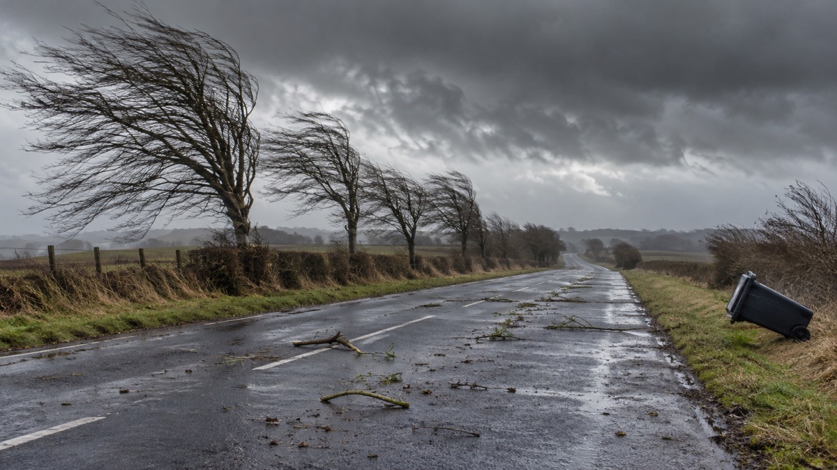
Storm Éowyn brought very strong winds and heavy rain to parts of the UK on Friday 24 January 2025, with the highest gust of 100mph recorded at Drumalbin in Lanarkshire1. The Met Office said more than 100,000 properties were left without power, with further disruption caused by road and rail closures, fallen trees and damage to buildings1. A separate Met Office account of the storm reports that around a million homes were without power at the peak, with several thousand remaining without power in Scotland and Northern Ireland for a number of days2.
The Met Office issued a red warning for wind, meaning danger to life, covering Northern Ireland, Scotland's Central Belt and much of south-west Scotland, with a wider amber warning across the northern half of the UK2. The Scottish Fire and Rescue Service said a red warning for wind had been issued for the Central Belt of Scotland, Dumfries and Galloway and some of the Western Isles, with an amber warning for wind for the rest of the country and yellow warnings for wind and snow nationally3. It said travel conditions were likely to be extremely dangerous across parts of Scotland and that travel was not advised unless absolutely essential3.
The Cabinet Office issued Emergency Alerts to compatible mobile phones in the areas at most risk on the evening of Thursday 23 January. The Northern Ireland alert was sent at 5:25pm and the alert for 22 Scottish council areas at 5:50pm4. The Cabinet Office said approximately 4.5 million people would receive the alert, the largest real life use of the tool to date, and that phones would make a loud siren-like sound even if set on silent, lasting about 10 seconds6.
"The storm may damage infrastructure causing power cuts and disruption to mobile phone coverage. Consider gathering torches, batteries, a mobile phone power pack and other essential items you already have at home."
The Met Office's storm report records one fatality in Ayrshire as a result of a falling tree, and a further fatality in County Donegal in the Republic of Ireland2. It records that trunk roads were closed, all rail services were halted in Scotland and the West and East Coast Main Lines closed, that a section of the M9 was closed in both directions and part of the A1 closed due to overturned vehicles, and that ferry services and over 1,000 flights were reported cancelled2. In the red warning area, members of the public were advised to stay at home and all schools were closed2. The lowest pressure recorded was 941.9hPa on the Isle of Tiree, the UK's lowest value since 936.8hPa at Stornoway Airport on 24 December 20132. The Met Office describes Éowyn as the UK's most powerful wind storm for over a decade, and for Northern Ireland the most significant since the Boxing Day Storm of 26 December 19982.
| Measure | Detail |
|---|---|
| Highest gust | 100mph at Drumalbin, Lanarkshire1 |
| Other gusts | 96mph at Brizlee Wood, Northumberland; 93mph at Aberdaron, Gwynedd; 92mph at Killowen, County Down2 |
| Properties without power | More than 100,000 reported by the Met Office1; around a million at the peak in its storm report2 |
| Lowest pressure | 941.9hPa on the Isle of Tiree2 |
| Emergency Alerts | Northern Ireland at 5:25pm and 22 Scottish council areas at 5:50pm on 23 January 20254 |
The Scottish Fire and Rescue Service, responding during the storm, asked that people take care during a power cut and use safe ways to heat and light their homes as well as cook3. It also asked the public to dial 999 only where there was an immediate risk of harm, and to contact the local authority about fallen trees or obstacles that did not pose an immediate risk to the public or property3.
Why it matters for households
The red warning area covered all of Northern Ireland and Scotland's Central Belt, where people were advised to stay at home and schools were closed2. The Emergency Alerts warned that the storm could damage infrastructure causing power cuts and disruption to mobile phone coverage, and advised people to stay indoors if they could, said it was unsafe to drive in the conditions and, in the Scottish alert, to avoid coastal areas4. The alerts advised people to stay up to date with the weather forecast and to follow advice from emergency services, network operators and local authorities4. Households preparing for storm conditions can read our guides to storms and the electricity network and to power cuts, and drivers can read how to drive safely in strong winds.
What happens next
The Met Office reported on 27 January that Éowyn had cleared away from the UK on the Saturday, before another low-pressure system moved in on the Sunday1. That system was named Storm Herminia by the Spanish Meteorological Service and did not meet the criteria to be named by the Met Office's storm naming group1. Yellow warnings for rain and wind were in place across Wales and much of southern England covering Monday into Tuesday, with the rain warning for parts of Wales not ending until 21:00 on Tuesday1. The Met Office said Storm Herminia would move away from the UK by Wednesday, and that a quieter spell was expected from Thursday as a ridge of high pressure crossed the UK1.
Sources (6)
- An unsettled start to the week with wind and rain warnings in force - Met Office, metoffice.gov.uk
- metoffice.gov.uk, metoffice.gov.uk
- Storm Éowyn - updates | Scottish Fire and Rescue Service, firescotland.gov.uk
- Emergency alert - GOV.UK, gov.uk
- Emergency alert - GOV.UK, gov.uk
- Government to issue Emergency Alert in response to Storm Éowyn - GOV.UK, gov.uk
 Storms and the Electricity Grid
 Power Cuts Household Guide
 Driving in Strong Winds





