Storm Boelo, the second named storm of the season, will arrive from the Atlantic during Saturday, the Met Office said. The forecaster expects the strongest winds across Scotland, Northern Ireland and northern England, with heavy rain spreading eastwards through the day and unsettled conditions continuing into Monday1.
The Met Office said gusts of 60 to 70 mph are possible, with potentially higher speeds in exposed locations1. Its deputy chief forecaster, Chris Bulmer, put the figures higher for exposed ground:
"Gusts of 70-80mph in exposed coastal areas and high ground are possible, with 50-60mph gusts more widely. The strong winds will be accompanied by heavy rain, making for an impactful weekend of weather. Severe weather warnings and forecast detail will continue to develop, so people should keep up to date with the forecast over the next few days."
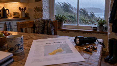
Warnings issued by the Met Office differ in timing and coverage between reports. The Met Office blog says warnings for strong winds run from Friday, Saturday and into Sunday, covering Northern Ireland, Scotland and parts of northern England1. The Standard reports a yellow wind warning for the whole of mainland Scotland, the Western Isles, Orkney and the far north of England from 6pm on Saturday to 9pm on Sunday, with widespread gusts of 55-65 mph and up to 70-80 mph in more exposed coastal locations, and a separate yellow warning for Northern Ireland from 6pm on Saturday to 3pm on Sunday, warning of 50-60 mph gusts and up to 65-75 mph in exposed regions2. Live for the Outdoors refers to amber weather warnings being in place for both storms3.
| Area | Wind warning as reported by The Standard2 | Gusts warned |
|---|---|---|
| Mainland Scotland, Western Isles, Orkney, far north of England | Yellow, 6pm Saturday to 9pm Sunday | 55-65 mph widely, 70-80 mph in exposed coastal locations |
| Northern Ireland | Yellow, 6pm Saturday to 3pm Sunday | 50-60 mph, up to 65-75 mph in exposed regions |
Saturday begins calm and chilly in many places, with rain and strong winds moving into Northern Ireland, Scotland, Wales and western England and spreading eastwards through the morning and afternoon1. Sunday stays wet and windy across Scotland and northern England, with heavy rain continuing across northern and north-eastern Scotland for much of the day, while Wales, southern England and south-eastern England should be considerably drier but remain blustery1. Temperatures will generally reach between 11°C and 14°C, though the wind will make it feel colder1. The Met Office attributes the pattern to a powerful jet stream steering areas of low pressure towards the UK1.
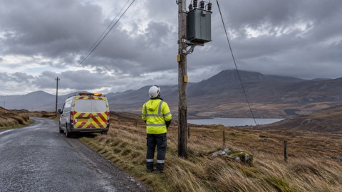
Storm Boelo follows Storm Austen, a separate low pressure system due to clear by Friday evening2. Live for the Outdoors reports that Austen had already arrived in south-west England, affecting the Isles of Scilly, Cornwall, Devon and parts of Wales, and that amber warnings were in place for both storms with a risk of disruption to transport systems and power networks3.
Why it matters for households
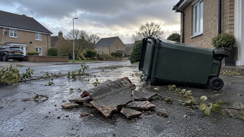
The Met Office says strong winds could generate large waves around exposed coastlines and cause travel disruption, and advises people planning journeys to check the latest forecast and warnings before travelling and to allow additional time where necessary1. The Standard reports that people are warned to stay away from cliff edges and from stormy seas, and are urged to check for loose items outside homes, such as plant pots, garden furniture, trampolines and bins, and to plan for them to be secured in high winds2. Its report also carries Met Office advice, given ahead of Storm Austen, that with trees in leaf fallen branches and trees could obstruct roads and railways2.
Live for the Outdoors advises walkers to consider postponing a walk if severe weather is forecast, to stay low and avoid exposed summits, ridgelines and high passes, to check the latest Met Office warnings and mountain-specific forecasts before setting off, to tell someone their route and expected return time, to carry waterproofs, warm layers, a hat and gloves, a fully charged phone, a map and compass and a headtorch with spare batteries, to allow extra time, and to turn back if conditions deteriorate. It adds that in a genuine emergency in the UK people should call 999 and ask for Police, then Mountain Rescue where appropriate3. The Met Office publishes warnings and forecasts on its website and app1; this guide explains how to sign up for Met Office weather alerts and what the yellow, amber and red warning levels mean.
What happens next
The Met Office expects the unsettled conditions to continue into the beginning of next week because the jet stream will remain strong, with another area of low pressure possibly bringing further wet and windy weather on Monday and north-western parts of the UK again likely to see the most unsettled conditions1. The Met Office said severe weather warnings and forecast detail would continue to develop2. Further reporting on Storm Boelo, including how supplies were restored, is collected in Storm Boelo: what happened and how supplies were restored, within the guide to storms and snow.
Sources (3)
- Weekend weather: Wet and windy as Storm Boelo arrives - Met Office, metoffice.gov.uk
- Second named storm of season to hit the UK this weekend | The Standard, standard.co.uk
- Storms Austen and Boelo: hiking safety advice, livefortheoutdoors.com